Highlights
Each year our exhibitors bring extraordinarily rare, beautiful and unusual items for sale.
Here is a selection of the items offered in 2025 by our exhibitors. These may still be available for purchase. If interested, contact the respective exhibitor directlyCloser to the 2026 Fair, new highlights of what will be on offer in 2026 will be posted. Bookmark this page and visit again to see the 2026 highlights.
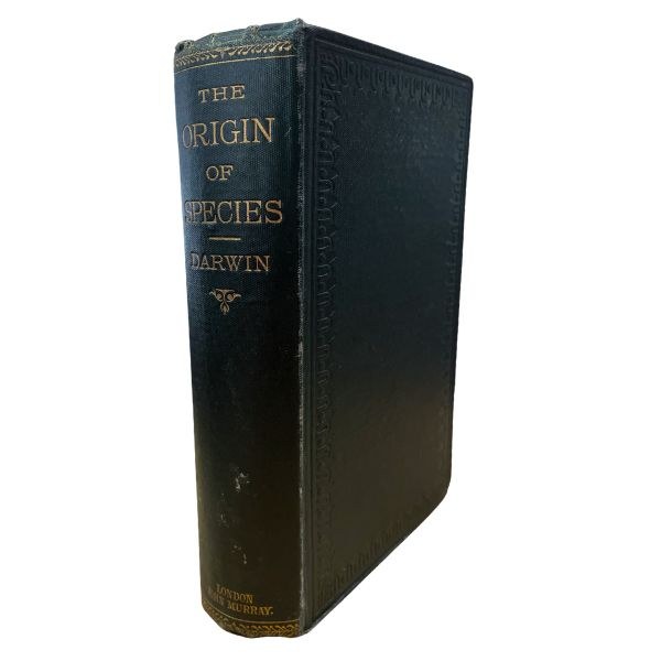
The Origin Of Species By Means of Natural Selection | Charles Darwin
$2950
According to the well-credentialled Forum Auctions in London:- “The printing of 1876 is the final text as Darwin left it. The issue was limited to 1,250 copies only. This number is as small as any, being equalled only by that of the first edition and is remarkably hard to come by (Freeman pp 80-81 of F401)" So, this copy is a very good example of the Sixth 'Eighteenth Thousand' Edition but note: the actual print number as quoted has recently been disputed elsewhere and possibly may have been as many as 2000 copies. Still, very scarce with about 150 years of age patina.
View More
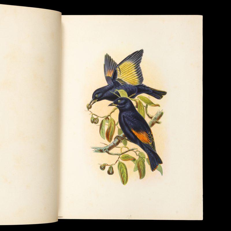
The avi-fauna of Australia : comprising Gould’s Birds of Australia and all other birds discovered in the Australian colonies since 1850
$35000
[Sydney?] : [G.J. Broinowski?], 1897. One of the rarest publications on Australian ornithology, one of only two known copies, the only one in private hands.
In addition to its obvious desirability as an Australian colour plate book of almost unprocurable rarity, The avi-fauna of Australia is also meaningful insight into the debt Broinowski felt to Gould, and the respect he afforded the scientific community who contributed to our collective understanding of Australian ornithology.
Provenance:
Quentin Keynes (1921 – 2003), explorer, filmmaker, and great-grandson of Charles Darwin.
View More
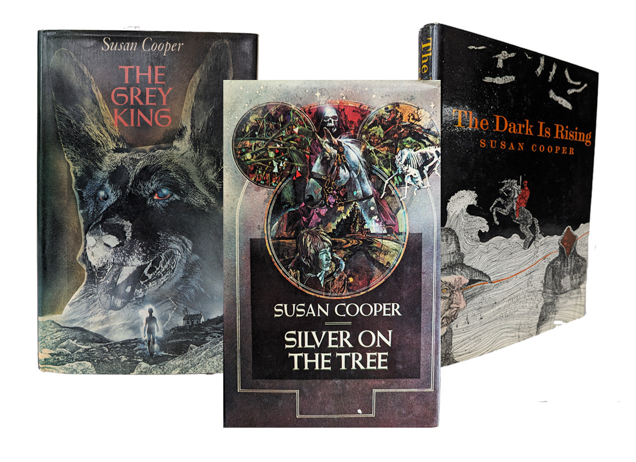
Susan Cooper - The Dark is Rising
Three novels in the Dark is Rising quintet by Susan Cooper, a contemporary fantasy series set in England and Wales, which incorporates British mythology such as the Arthurian legends and Welsh folk heroes.
The Dark is Rising (2nd imp 1975, $275),
The Grey King (1st ed. 1975, $350) and,
Silver on the Tree (1st ed 1977, $150).
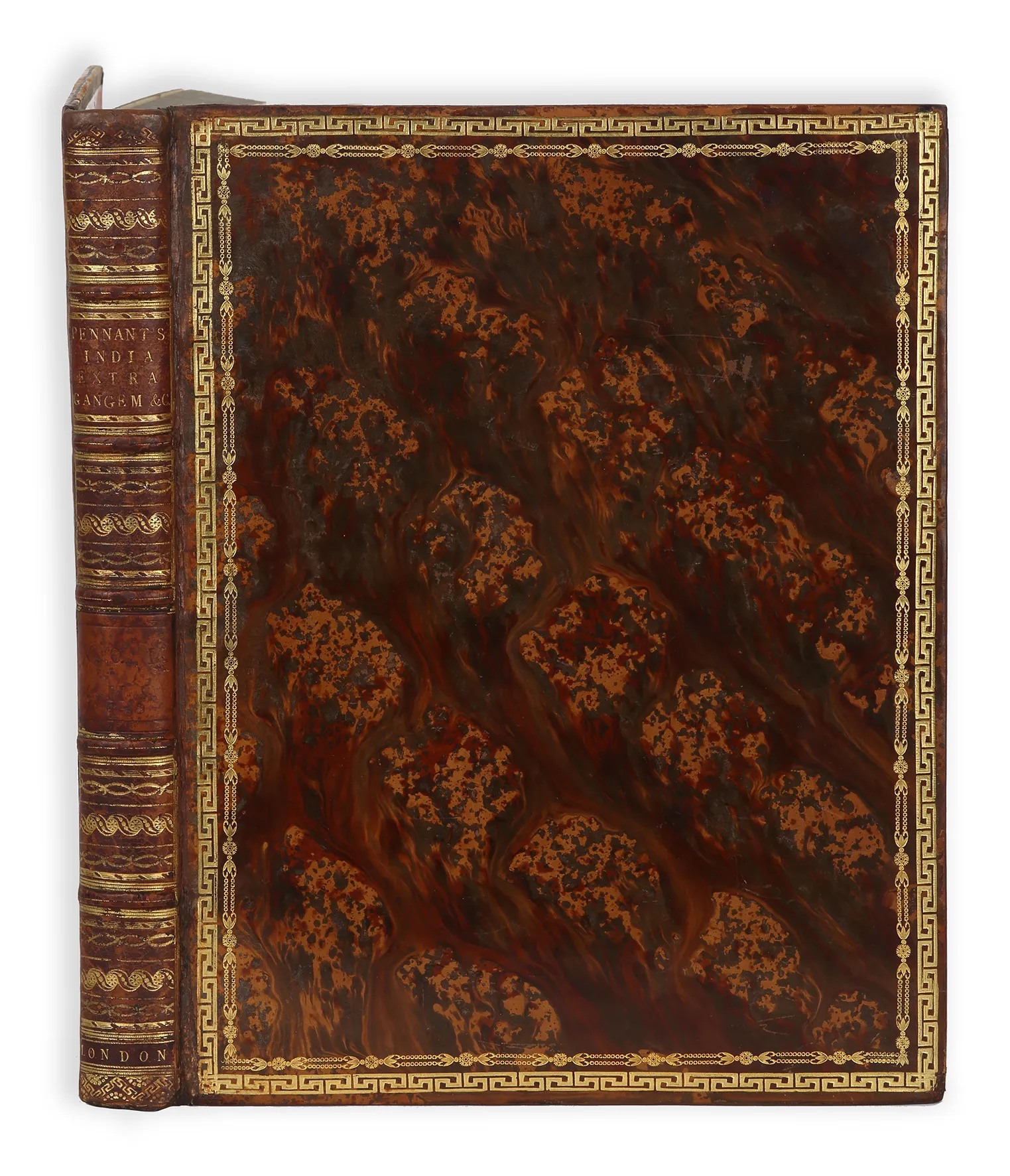
Pennant’ Outlines of the Globe, vol. 4
$4850
The rare fourth volume of Pennant’s Outlines of the globe containing the large map of Australia, titled: Map For Mr. Pennants Outline of the Globe. Beautifully bound in striking contemporary hand painted tree calf
View More
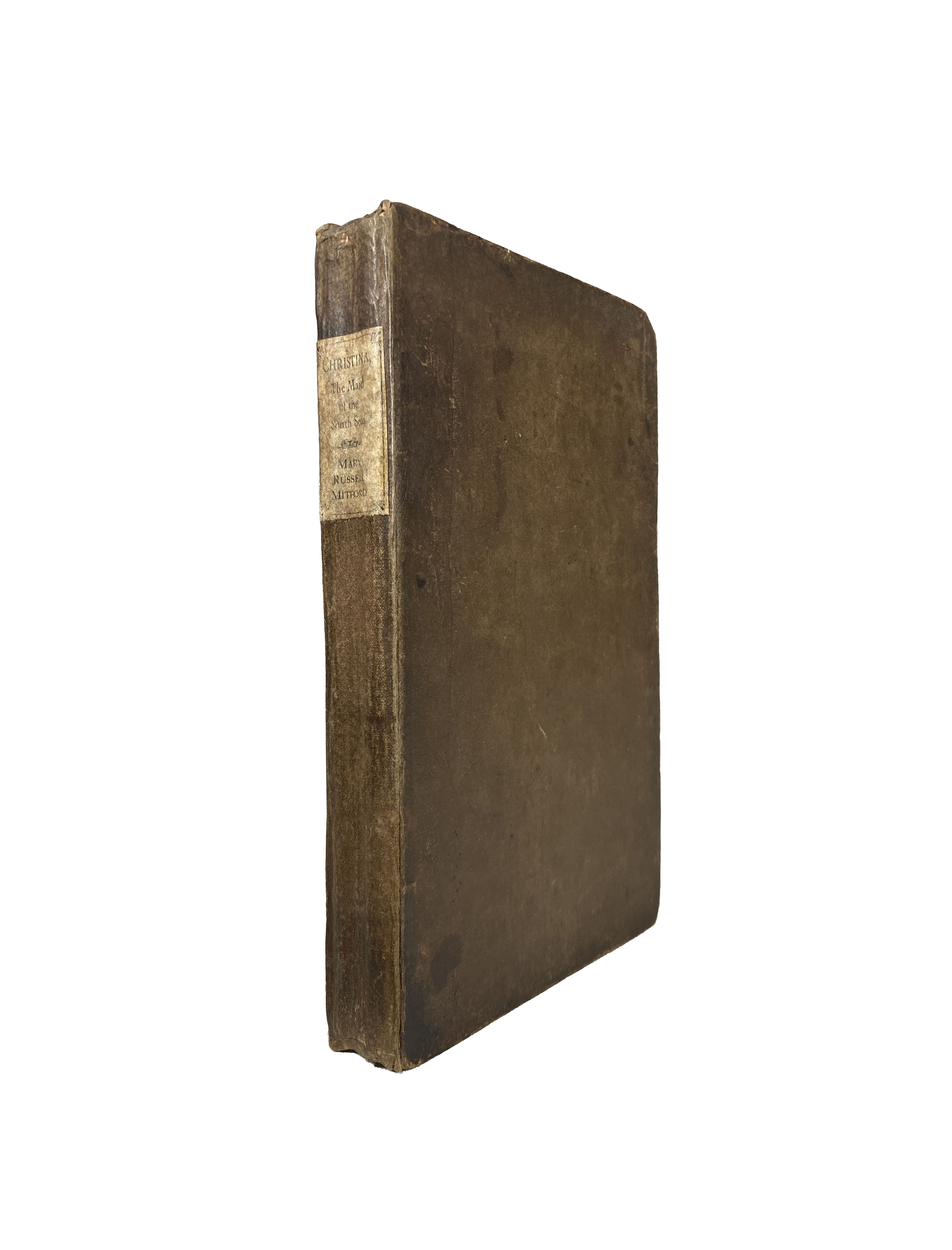
Christina, the Maid of the South Seas; a Poem.
$4000
MITFORD, Mary Russell .
London: Printed by A. J. Valpy for F. C. and J. Rivington, 1811. First Edition.
Mary Russell Mitford's (1787-1855) second published title.A metrical tale based on the first news of discovery of the last surviving mutineer of the H. M. S. Bounty and a generation of British-Tahitian children on Pitcairn Island in 1811. As a manuscript, the work was apparently read and corrected by James Burney who sailed with Captain James Cook and the proofs were corrected by Samuel Taylor Coleridge. A scarce item.

Andy Pollitt, Punk in the Gym
$250
Pollitt, Andy. Punk in the Gym. 1st edition. 2016. Sheffield: Vertebrate Publishing.
8vo. Original black cloth in dustjacket; pp. 318, with illustrations. No. 107 of a limited edition of 200 cloth-bound copies signed by the author. A fine copy. The life story of highly talented British climber, Andy Pollitt, and his relationship with Wolfgang Gullich’s 1984 test piece Punks in Gym, an exceedingly difficult rock climb at Mt Arapiles, in Western Victoria, at the time the hardest climb in the world. Publisher, Jon Barton, rates this book his personal favorite among the Vertebrate list.
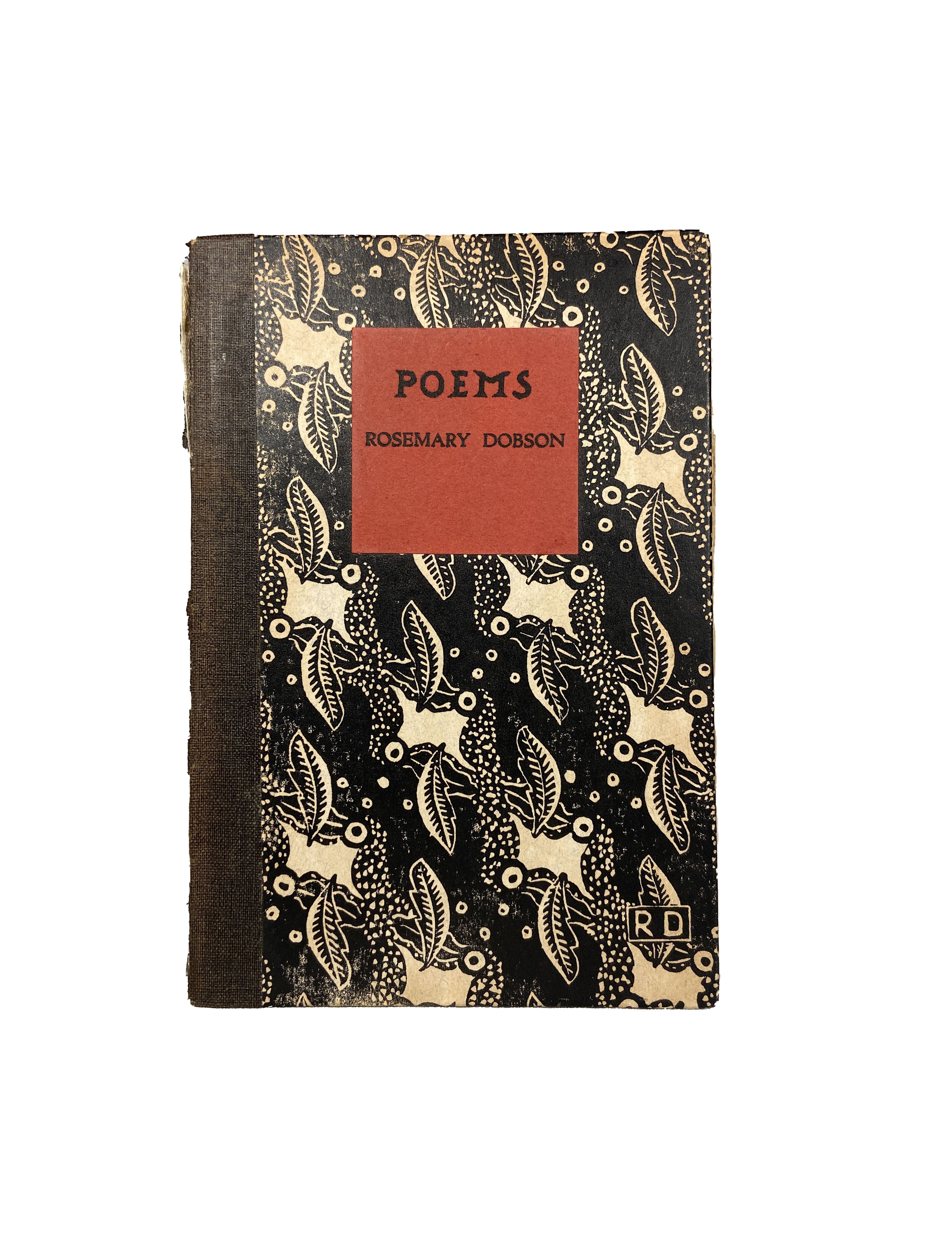
Dobbson's first book restricted to 200 copies and published when she was only 17.
$500
Rosemary Dobson.
Poems.
[Mittagong, NSW]: Frensham Press, 1937. First Edition. Paper boards with black and white lino cut designed by Rosemary Dobson with her monogrammed initials : red paper label lettered in black : black cloth spine.
The Press was established by the Australian children's author Joan Phipson after she visited some private presses in England and consulted Leonard and Virginia Woolf at their Hogarth Press. Leonard Woolf was later to praise Dobson's book as equal to any of the initial efforts by the Hogarth Press.
View More
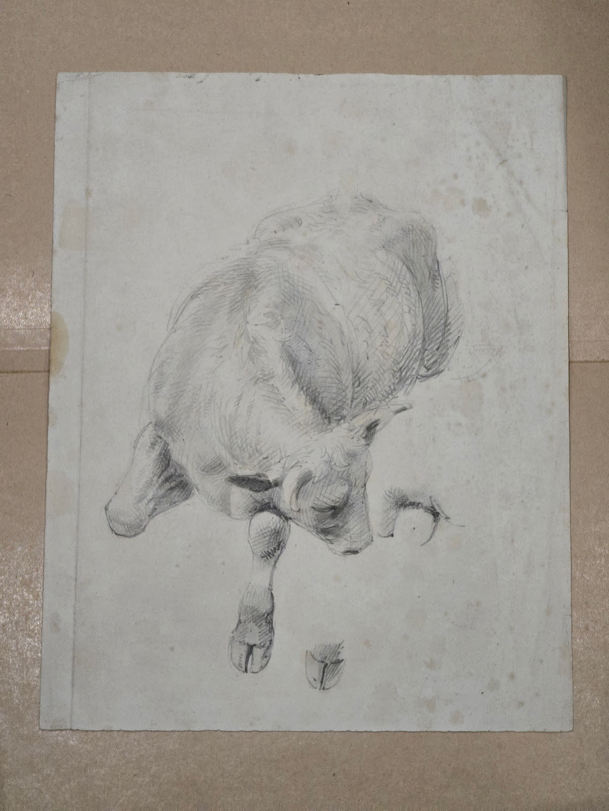
Studies of a Bullock and a Hoof by William Strutt (1825 - 1915)
$3500
Pencil on wash with measurements 29 x 22.7 cm. Provenance: Private Collection, North Wales, part of a collection of works by William Strutt and Alfred William Strutt sold at Sotheby's, Chester, March 1991: John Ness Barkes & Edward Barkes
Probably a study for Black Thursday: A search for life through Cape Otway Forest on the memorable Feb 6th 1851. Plate 14, page 29, Victoria the Golden, Scenes, Sketches and Jottings from Nature by William Strutt, Melbourne, Victoria 1850-1862
View More
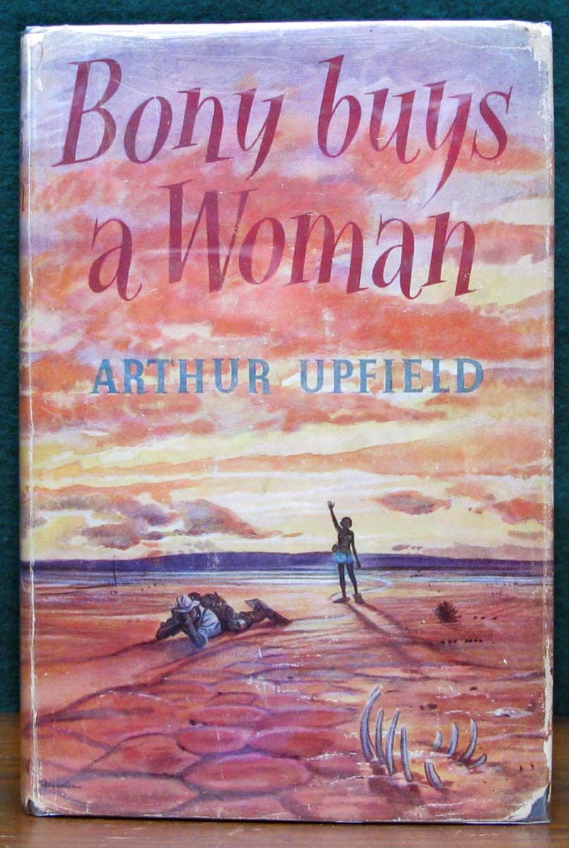
Bony Buys a Woman By Arthur Upfield (Signed)
$350
BONY BUYS A WOMAN
By Arthur Upfield
Lond. Heinemann. 1957.
First Edition. Scarce.
Inscribed & signed by Arthur Upfield
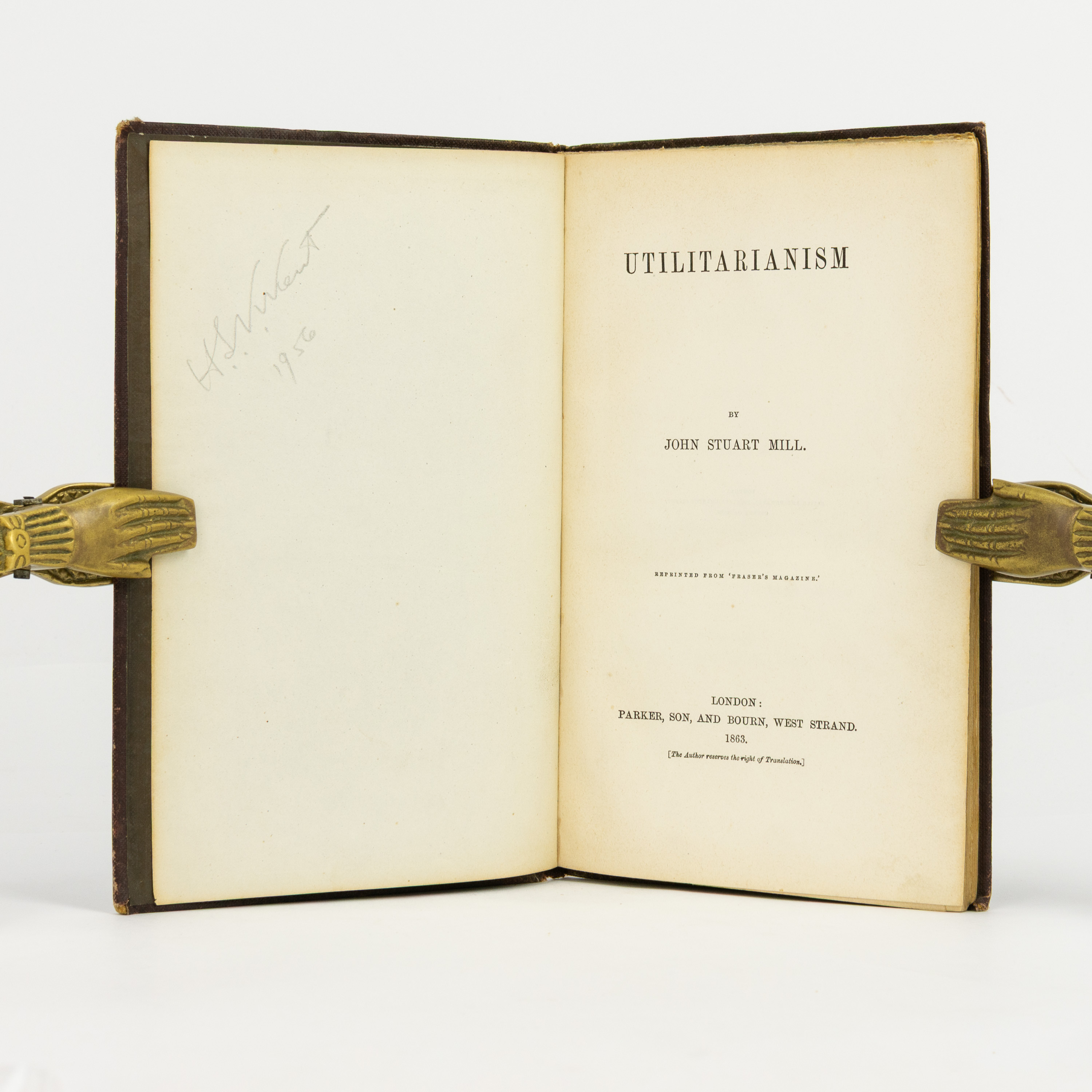
John Stuart Mill: Utilitarianism
$9500
London, Parker, Son, and Bourn, 1863 [first edition in book form].
Mill's definitive statement on moral philosophy. The text was first published as a series of three articles in 'Fraser's Magazine' in 1861; this first edition in book form is rare.
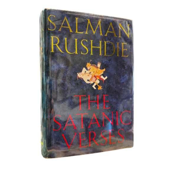
The Satanic Verses | Signed Copy | Salman Rushdie
$8000
This immaculate first edition, signed and dedicated by the author, will further become one of the prize editions in English literature. Rushdie is understandably unlikely to ever commit to any public signings again.
View More
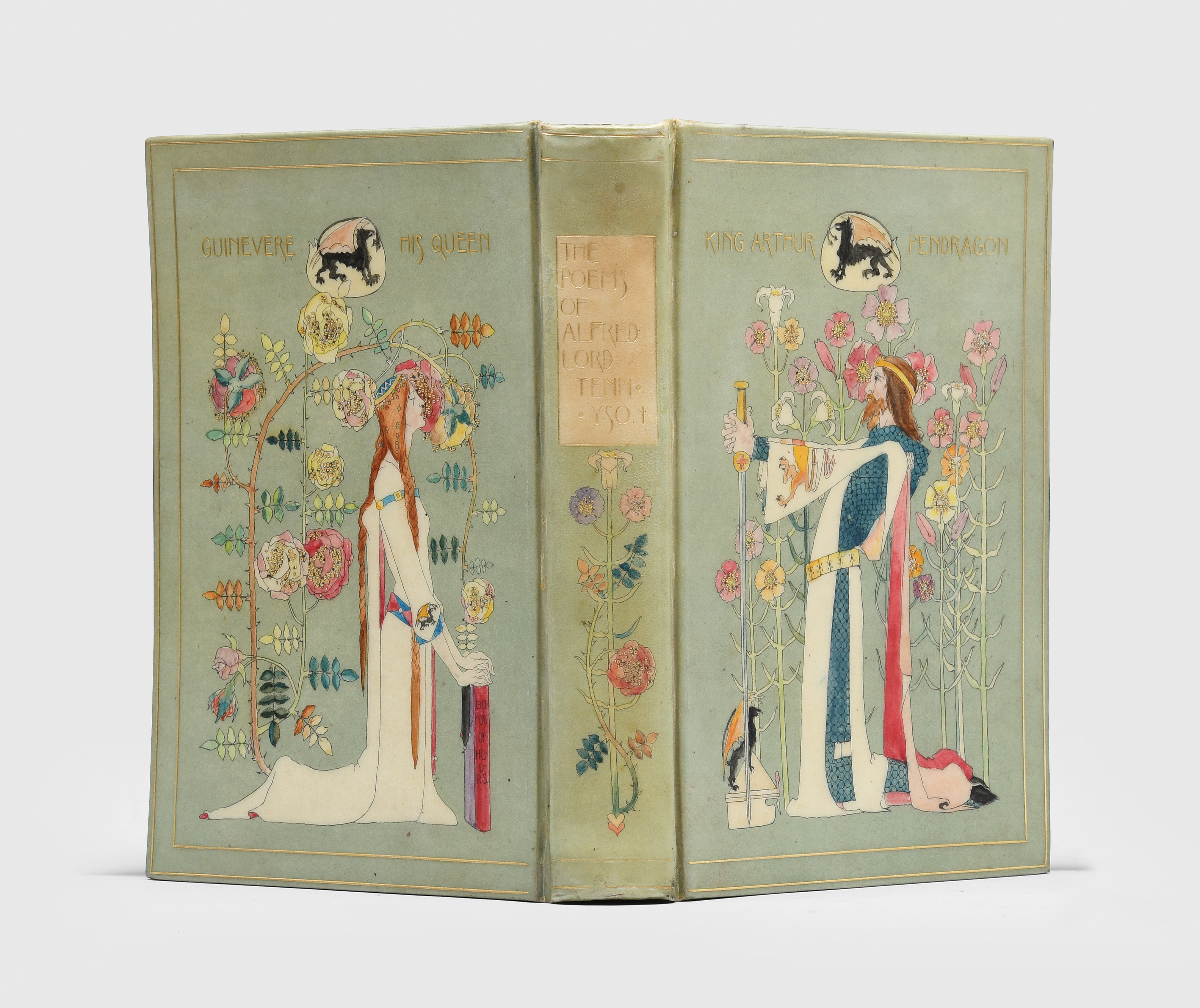
CHIVERS BINDING - TENNYSON, Alfred. Poetical Works.
$14100
A “vellucent” style binding, with delicately rendered Arthurian figures after Dorothy Carlton Smyth (1880-1933), the most prolific of Chivers’s female designers. Smyth was particularly involved with the Glasgow School of Art, who appointed her as their first female director. Her stained glass Tristan and Iseult, the subject of one of Tennyson’s Arthurian poems, garnered wide acclaim at the 1901 International Exhibition.
View More
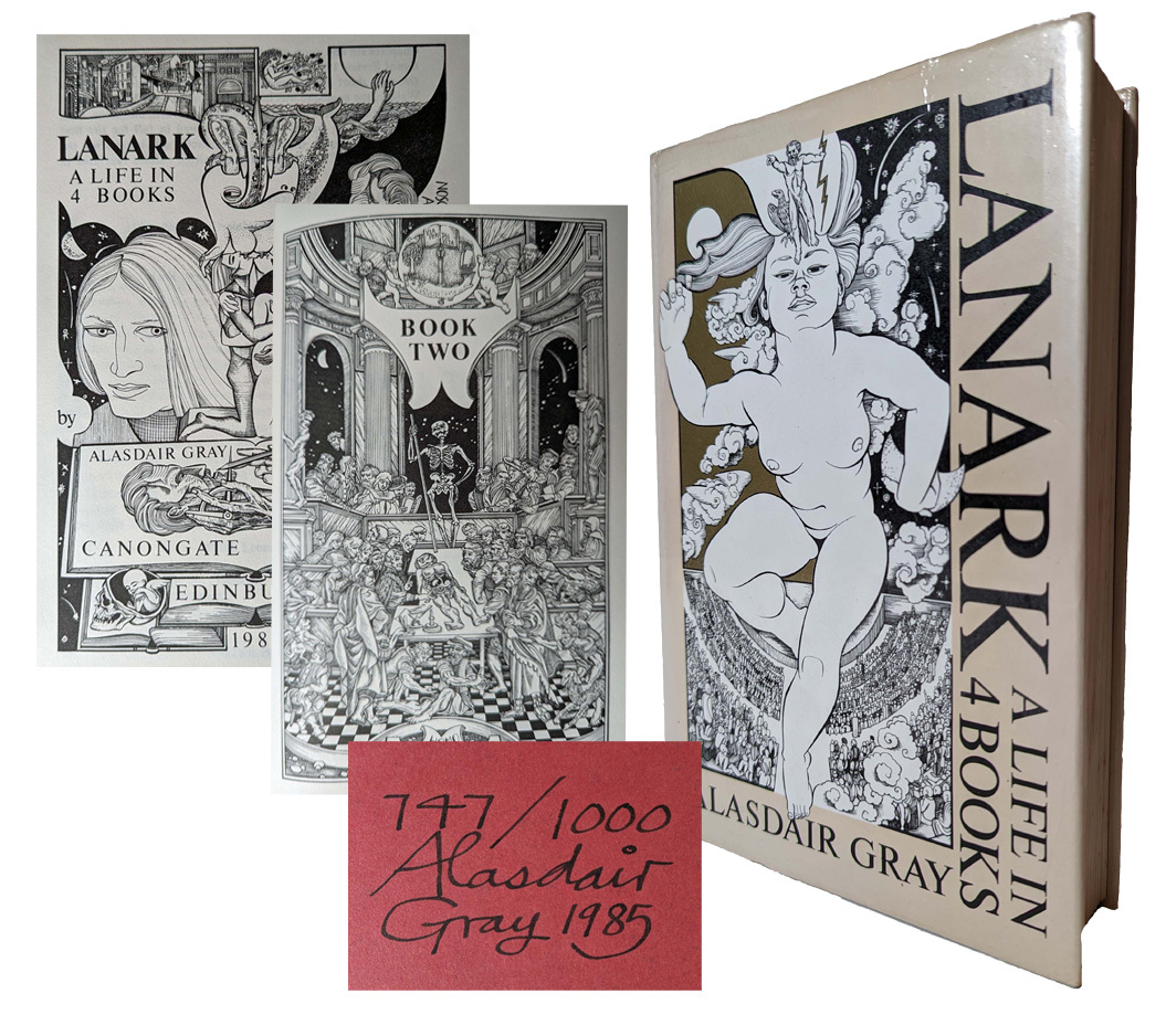
Alasdair Gray, Lanark
$750
Gray, Alasdair. Lanark. A Life in 4 Books. 1st thus ‘Definitive Edition’,1985. Edinburgh: Canongate. 8vo. Original black cloth gilt in dustjacket; pp. [viii (last blank)], 562 (last blank), illustrated and decorated throughout by the author. No. 747 of a limited edition of 1000 copies, numbered, signed and additionally inscribed by Alasdair Gray. A little sunning and spotting, a very good copy.
The author’s first book, a novel written over a period of almost thirty years, combining realist and dystopian surrealist depictions of his home city of Glasgow. First assembled in one book in 1981.
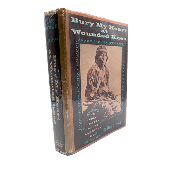
Bury My Heart at Wounded Knee | Dee Brown
$3900
An American bestseller in hard cover for over a year post publication, selling many millions of copies and was translated into seventeen languages, Brown became a celebrated author of both fiction and non-fiction until he died in 2002.
View More
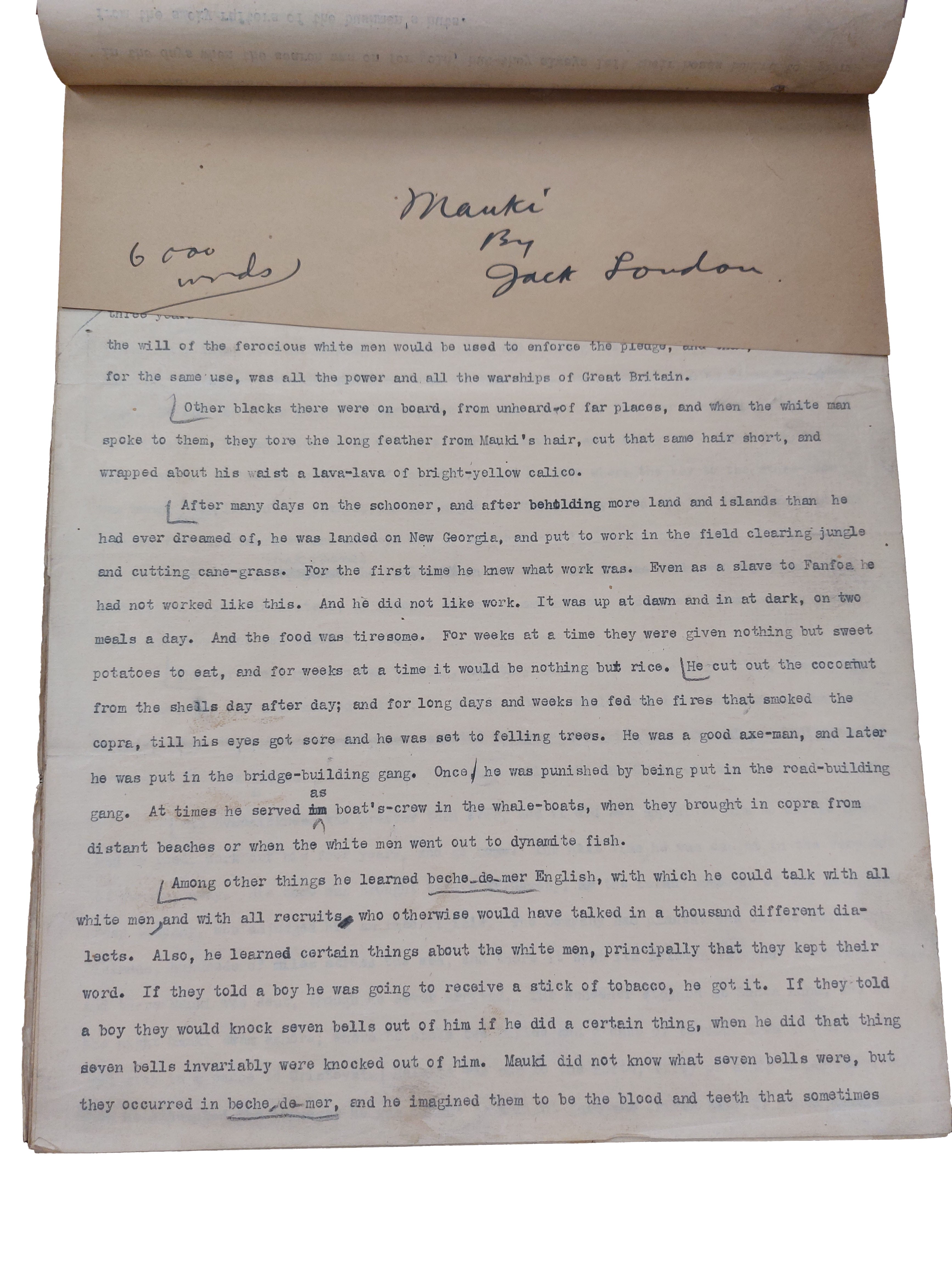
Typescript of Jack London's South Sea story, "Mauki"
$58000
“Mauki” holds significant literary and historical importance for the South Pacific, particularly in its depiction of colonial labour practices and indigenous resistance during a period of intense imperial activity.
Written in 1907 during London's cruise of the South Pacific in the Snark, "Mauki" was first published by Hampton's Magazine in December 1908 and was collected in South Sea Stories in 1911. This is the Hampton's setting copy and is one of only a handful of Jack London manuscripts to come onto the market in the past 50 years.
View More
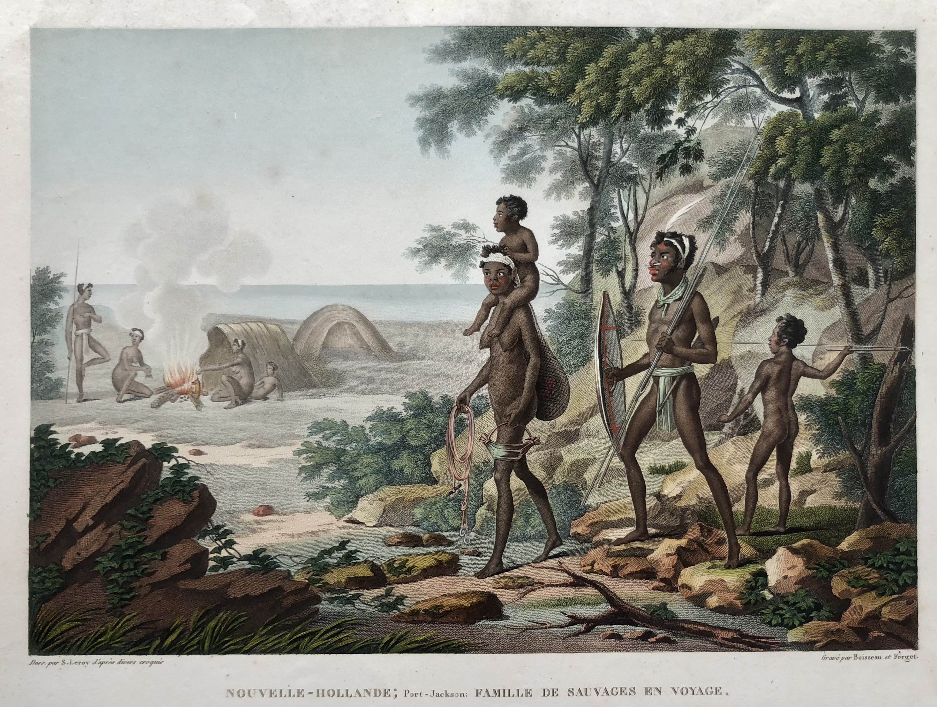
“NOUVELLE-HOLLANDE; PORT-JACKSON: FAMILLE DE SAUVAGES EN VOfYAGE”; SEBASTIAN LEROY, 1824.
$950
“NOUVELLE-HOLLANDE; PORT-JACKSON: FAMILLE DE SAUVAGES EN VOYAGE.”
1824
SEBASTIAN LEROY [drawn by]
BOISSEAU & FORGET [engraved by]
Stipple engraving printed in colour, [finished by hand-watercolour]
DESCRIPTION:
Early and interesting depiction of indigenous Australians in Port Jackson, Sydney Harbour, N.S.W.
An Aboriginal family in the foreground, walking past a camp in the background where another indigenous family is cooking an animal on an open fire.
NOTE:
Without number 102; From first edition of: “Voyage autour du Monde” by Louis Freycinet.
View More
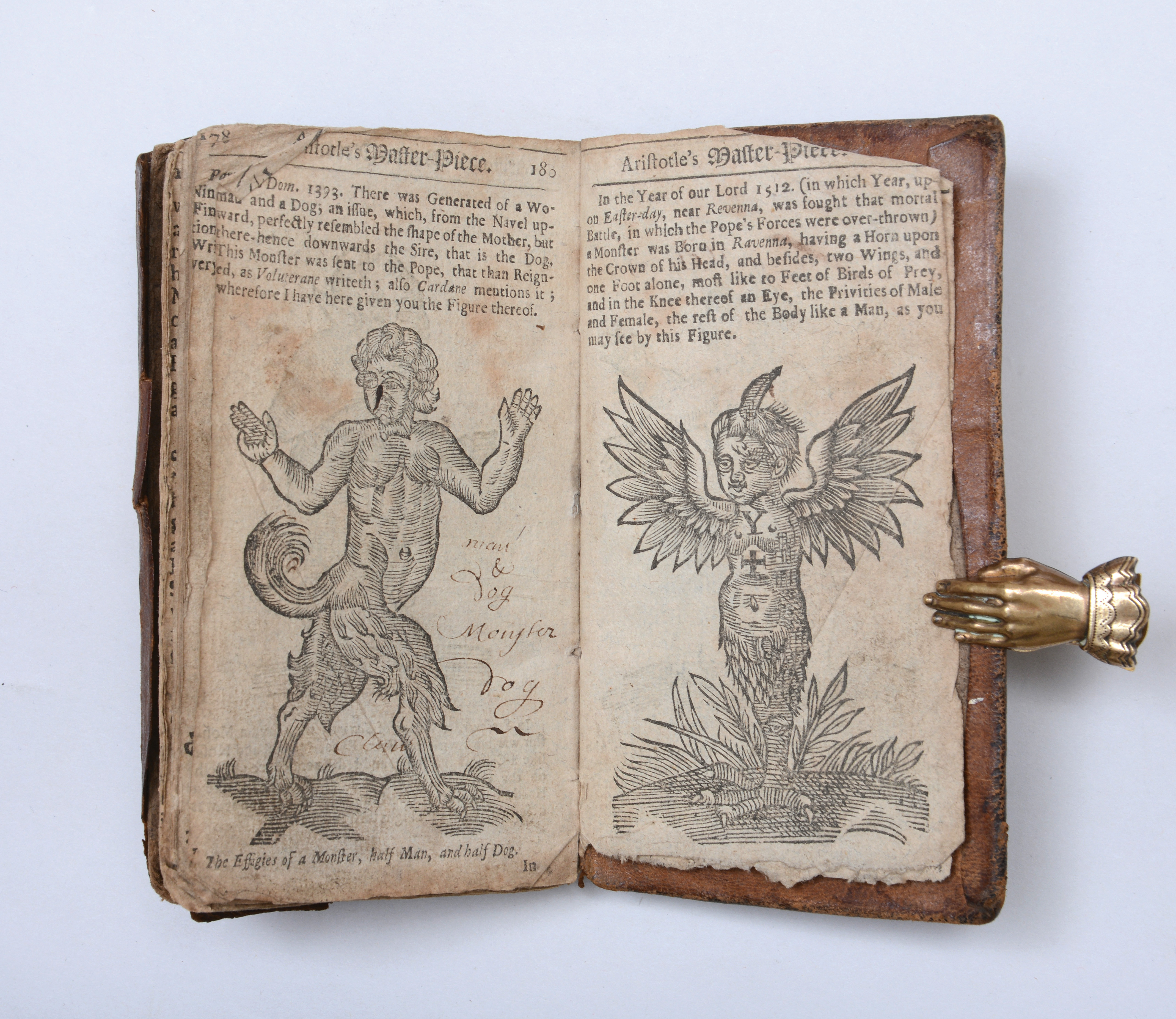
PSEUDO-ARISTOTLE. Aristotle’s Master-Piece.
$36600
Rare early edition of “the first sex manual written in English” (Norman), for centuries the most popular compendium on conception, pregnancy, and childbirth. This copy has contemporary annotations by a husband and wife in the midst of conceiving and giving birth to their second child. Winifred and Francis Witham of South Normanton both inscribed the book in 1699, two years after their marriage.
View More
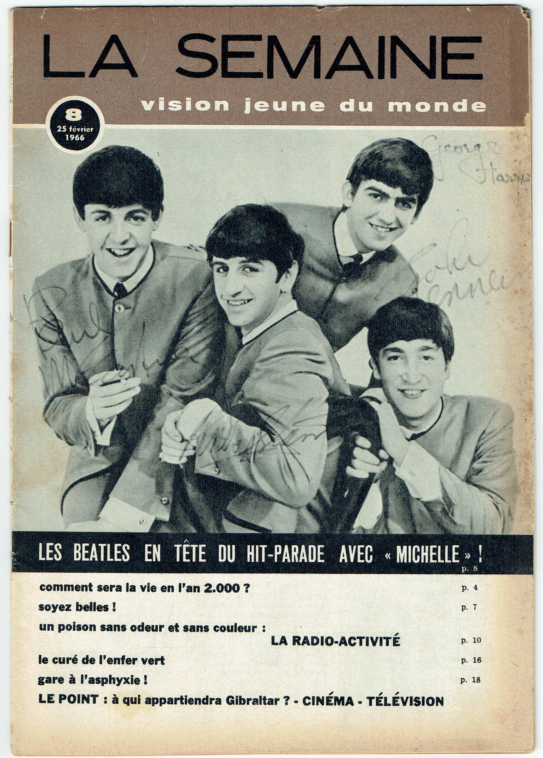
The Beatles: Autographed Magazine by all four Beatles.
$31300
A February 1966 edition of the French magazine ‘La Semaine’ that has been autographed on the front cover by The Beatles in black felt tipped pen. The photo on the front of the magazine pictures the famous image of The Beatles in their famous grey collarless suits which was taken by Dezo Hoffman in his studio in Wardour Street, London, England in April 1963. The autographs were obtained during The Beatles tour of Germany which took place between 24th and 26th June 1966.
View More
![Post Office [1st UK]](https://rarebookfair.com/assets/catalogues/orchardbookshopadl@gmail.com/Bukowski-w.jpg)
Post Office [1st UK]
$1000
Bukowski's alter-ego Henry Chinaski at his finest [read most disgusting, most hilarious, most obscene, etc]. Post Office was Bukowski's first novel and his best. "It began as a mistake. It was Christmas season and I learned from the drunk up the hill, who did the trick every Christmas, that they would hire damned near anybody..."
View More
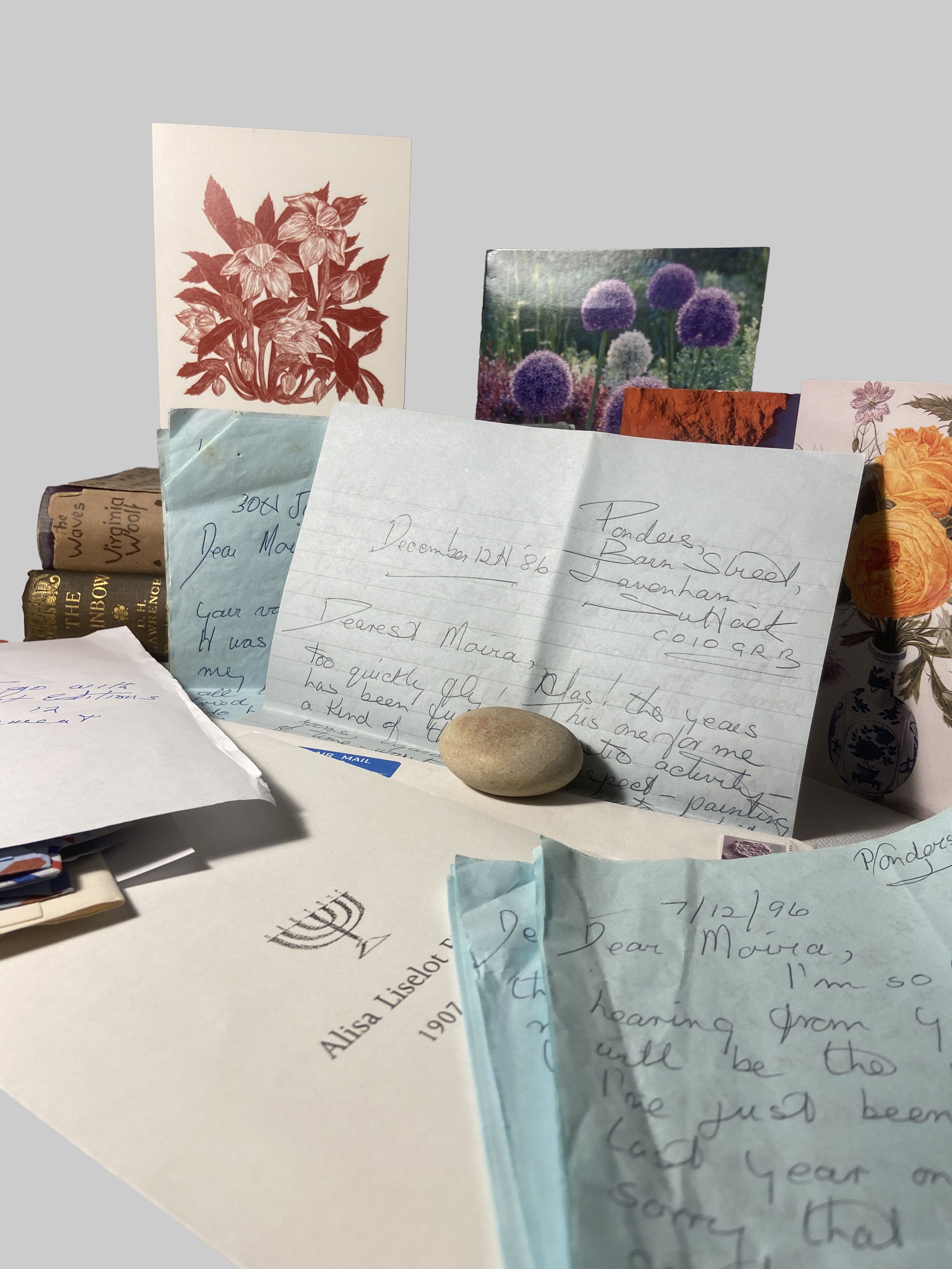
First time this pair have been offered for sale
$15000
Two first edition volumes from the library of Lady Constance Malleson: The Waves [offered with] The Rainbow [together with] A small archive of personal correspondence from the executrix of Malleson’s estate (Phyllis Urch) to a friend. The two books are from the library of Lady Constance Malleson: pacifist, actress, and long-term lover of Bertrand Russell.
View More
![BEAUTIFUL NATURAL HISTORY ILLUSTRATIONS. CAPESTRO (Federico). [Three illustrated notebooks.]](https://rarebookfair.com/assets/catalogues/mark@maggs.com/239832_02.jpg)
BEAUTIFUL NATURAL HISTORY ILLUSTRATIONS. CAPESTRO (Federico). [Three illustrated notebooks.]
$12500
Idrografia. Prospetto dei principali fiumi e laghi della Terra [e monti e vulcani]. Ms. in ink. 10 full page hand-coloured illustrations (9 on vellum), gold highlights throughout. Folio. Cloth-backed marbled boards. 36pp. “Premiato con diploma di 2o grada dalla Societa Patria in data 30 Novembre 1874.” [With:] Scienze naturali 1869. Gli ucceli. Ms. in black, red & blue ink. 39 hand-coloured drawings. Small folio. Cloth-backed marbled boards. 71pp. [And:] Storia degli animal di Capestro Federico A[nn]o 1869. Ms. in ink. 146 drawings. Small folio. Cloth-backed marbled boards. 108pp. 1874.