Highlights
Here is a small selection of the highlights offered in 2026 by our exhibitors for you to browse and whet your appetite. These highlights are only a small offering of what will be available at the fair.
Our exhibitors will be uploading more highlights regularly up to the opening of the fair.
If you are interested in a highlight, contact the respective exhibitor directly. Prices are in Australian dollars inclusive of GST.
![地球儀. [Early Japanese Globe in its Original Box].](https://rarebookfair.com/assets/catalogues/books@asiabookroom.com/220581_01.jpg)
地球儀. [Early Japanese Globe in its Original Box].
$2750
A miniature globe produced in 1875 by Mori Kinseki, a cartographer, noted lithographer and Nanga artist. The geographical detail is finely printed in delicate colours, with clear and precise line work. In the early Meiji period, the globe carried considerable symbolic significance, symbolising Japan's opening to the world. By the 1880s, globes were being introduced into primary schools for the teaching of geography. This earlier example is a scarce survivor.
View More
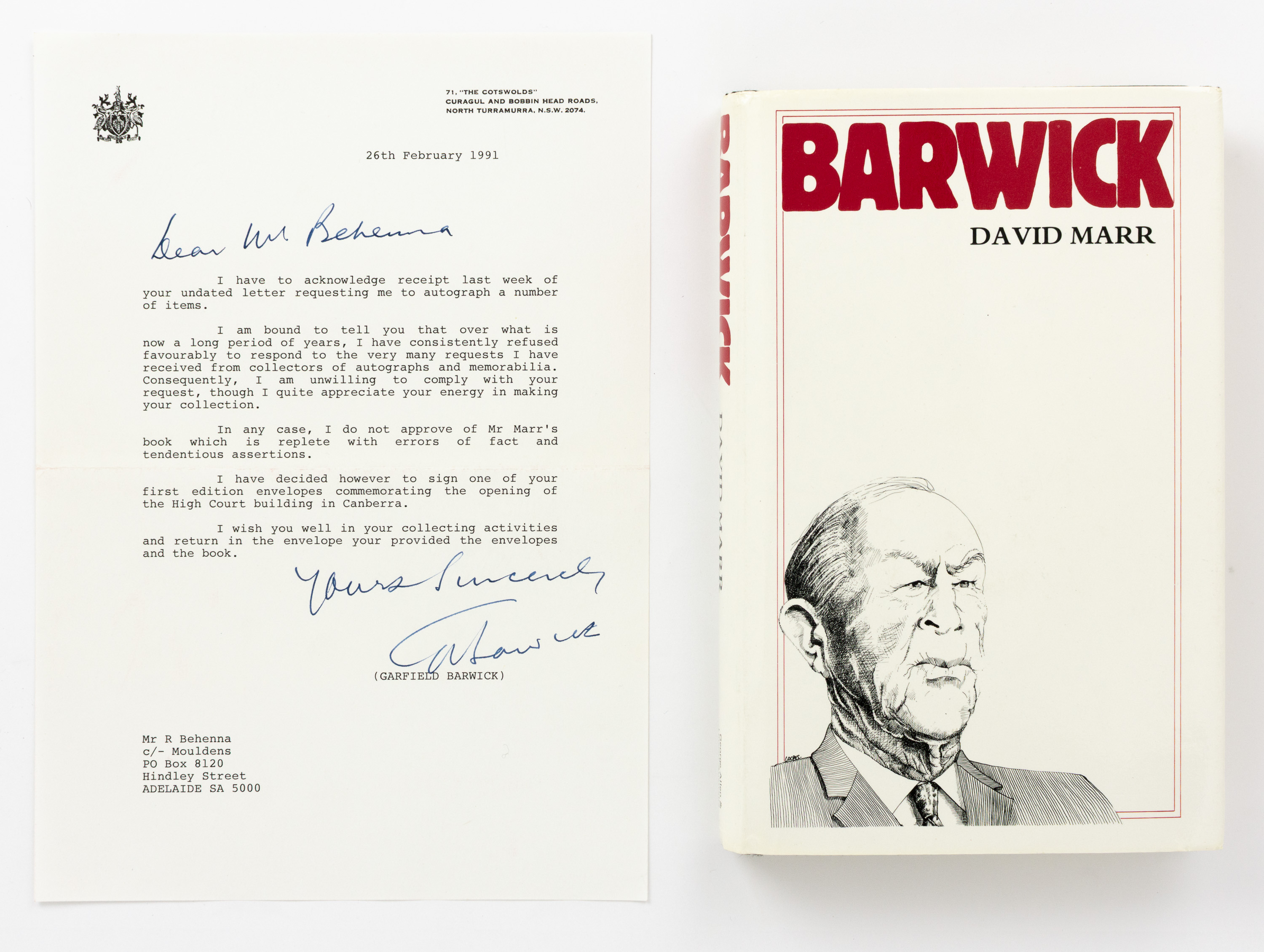
BARWICK, Sir Garfield: A word-processed letter signed by Sir Garfield Barwick, declining a request to sign a copy of David Marr's biography, 'Barwick'
$1000
The letter is dated 26 February 1991, and reads in part: 'I have to acknowledge receipt last week of your undated letter requesting me to autograph a number of items. I am bound to tell you that over what is now a long period of years, I have consistently refused favourably to respond to the very many requests I have received from collectors of autographs and memorabilia ... In any case, I do not approve of Mr Marr's book which is replete with errors of fact and tendentious assertions'
View More
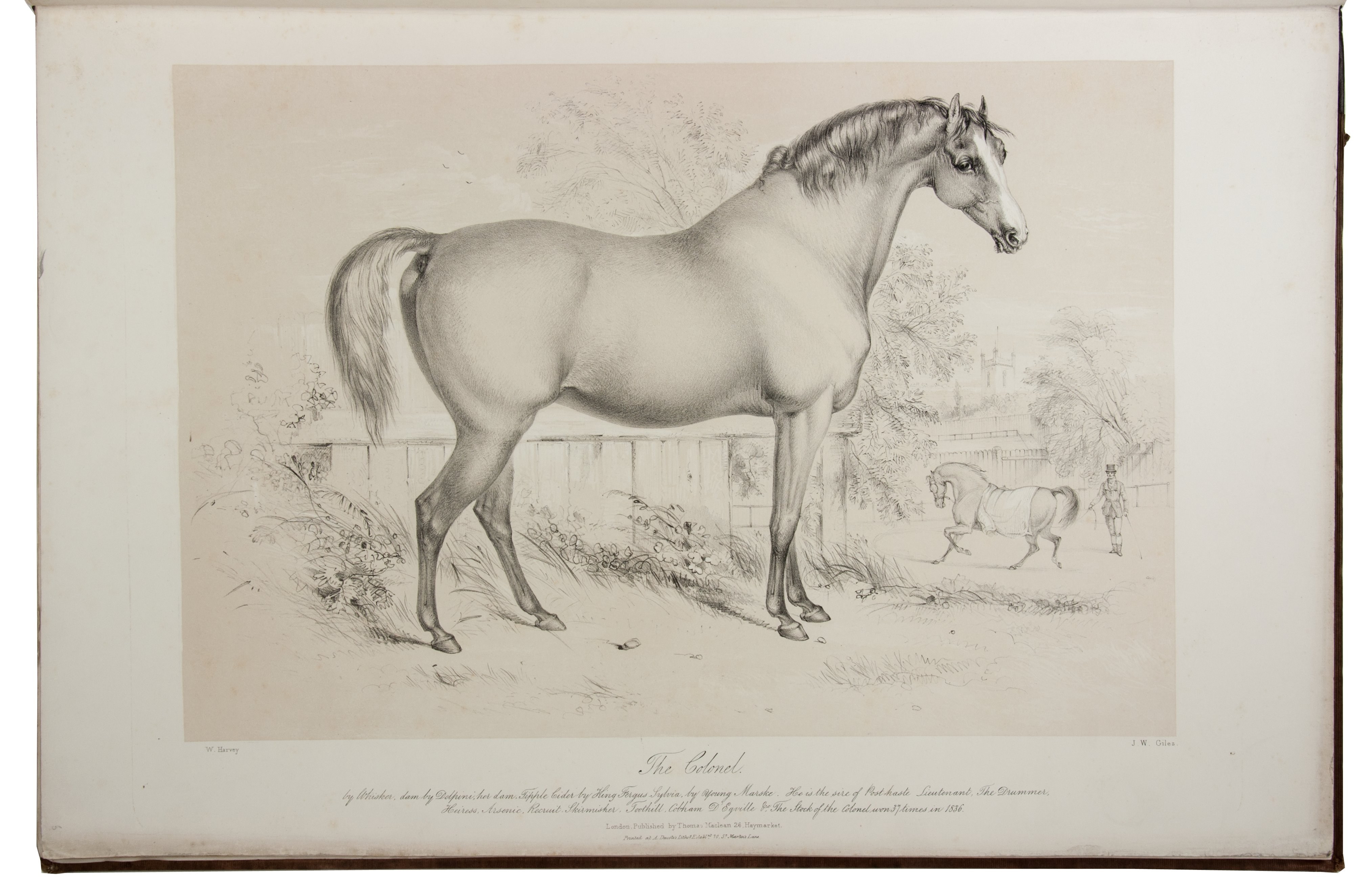
12 fine portraits of horses from the stables of Queen Victoria
$57500
HARVEY, William. Selections from the Royal stud, being portraits taken in October 1837, at Hampton Court, from life by William Harvey. Drawn on stone by and under the direction of R.J. Lane A.R.A. lithographer to Her Majesty.
London, Thomas McLean (printed by Alfred Ducôte and J. Graf), 1838. 1mo (55.5 x 38 cm). With a lithographed title page, a lithographed list of plates, and 12 tinted lithographed plates by Richard James Lane and W.J. Giles after William Harvey. Contemporary cloth, gold title on front board ("The royal stud at Hampton Court"); rebacked in modern, brown half sheepskin.
View More
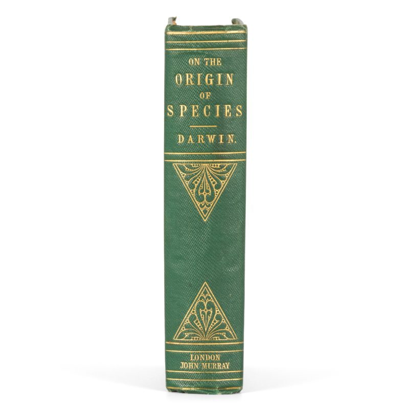
Chales Darwin's On the origin of species - first edition of 1859
$625000
An entirely unrestored, crisp and sharp copy of one of the most significant publications in the history of science, described as 'the most important biological work ever written'; and 'the most important single work in science'.
View More
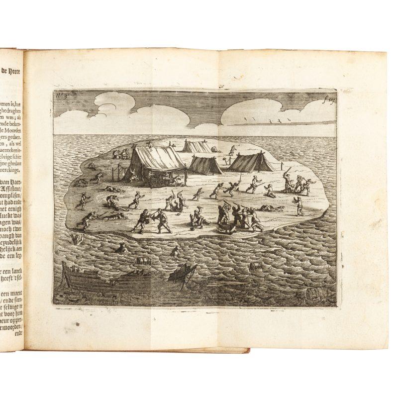
Ongeluckige voyagie, van’t schip Batavia, nae de Oost-Indien.
$165000
Amsterdam : Jan Jansz, 1647.
The first full account of the wreck of the Batavia, with the first printed European images of Australia, 'an especially outstanding rarity’ (Wantrup).
View More
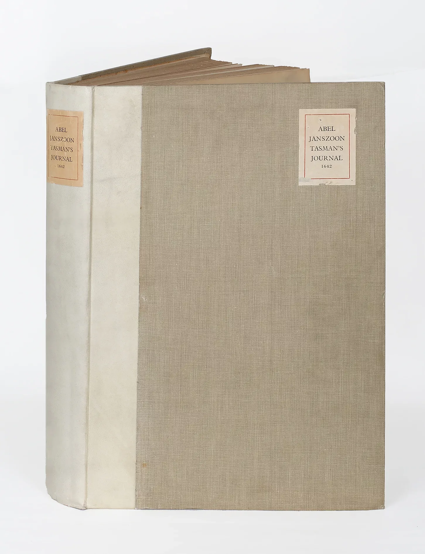
Abel Janszoon Tasman’s Journal of His Discovery of Van Diemens Land and New Zealand in 1642 with Documents Relating to His Exploration of Australia in 1644.
$4750
“The most comprehensive account of Tasman’s life and achievement; ” (Schilder, Australia unveiled, p.157) of which only 200 copies were printed.
View More
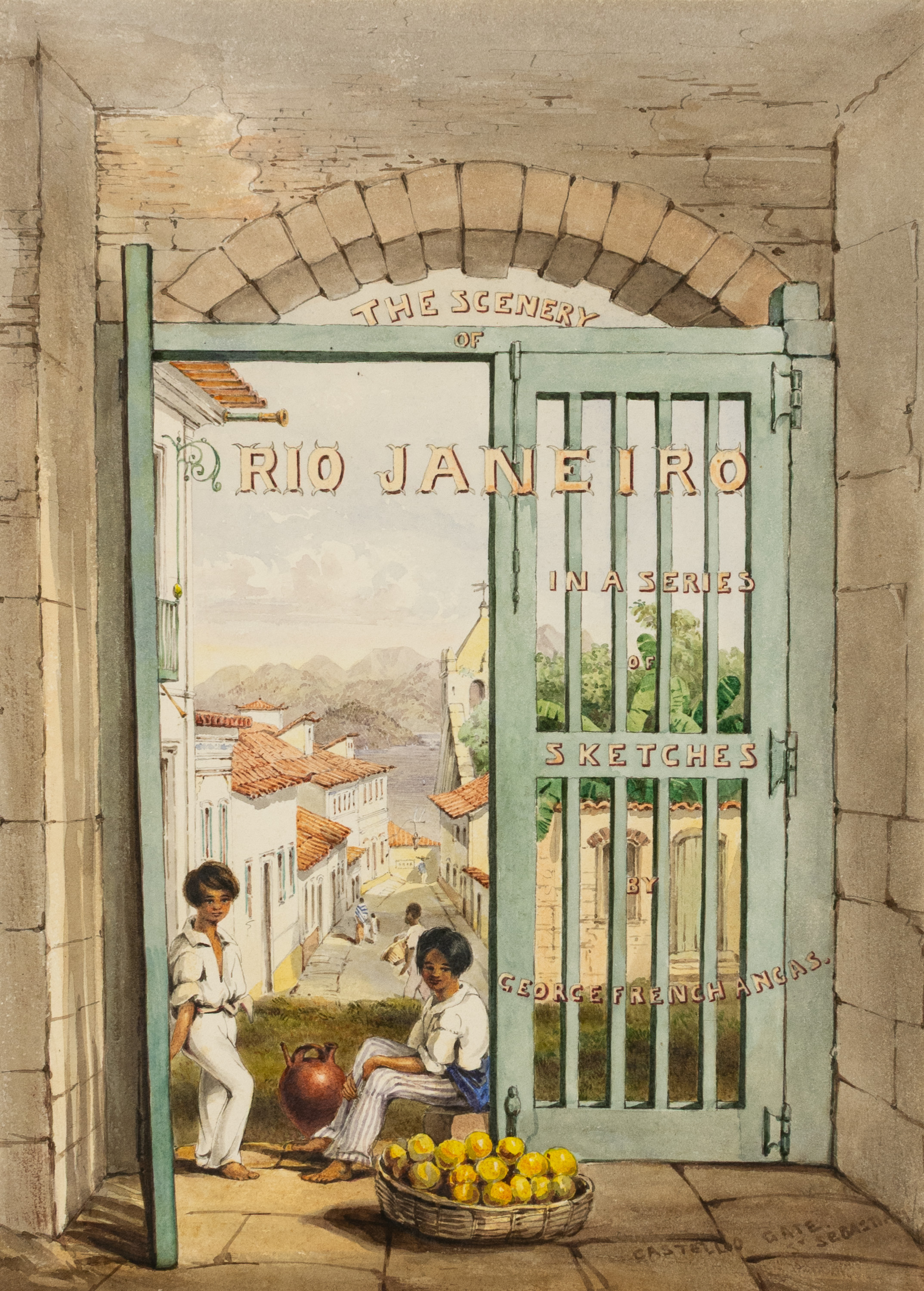
ANGAS, George French: A unique offering of eighteen original watercolours of Rio de Janeiro and the peoples of Southern Africa, many unpublished, together with a significant autograph letter signed by the artist
$650000
Watercolour and body colour on paper, most approximately 230 × 320 mm (or the reverse). All of these superb images are titled or captioned by the artist, and many are signed.
Eight views show Rio de Janeiro and environs, and were produced in 1845 in preparation for a never-published plate book.
The remaining ten views showing Zulu, Xhosa, Khoekhoe and Cape Malay peoples of Southern Africa, and were painted in 1846 and 1847.
View More
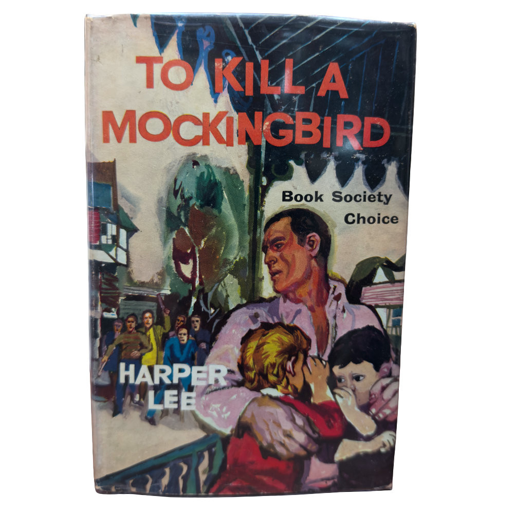
To Kill A Mocking Bird
$2300
1960 (First UK Edition). Heinemann, London, England
All three edges are slightly browned, though the text is in excellent shape with the only fault being a prior owner's signature on the front free endpaper, with no foxing at all either.
View More
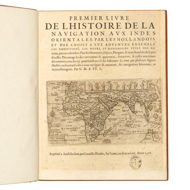
Premier livre de l'histoire de la navigation aux Indes Orientales
$25000
Amsterdam : Cornille Nicolas, 1598. The first edition in French of the major account of the first Dutch voyage to the East Indies, which was undertaken by a fleet under the command of Cornelis de Houtman (1565-1599). This voyage would lead to the creation of the Dutch East India Company (VOC) and result in Dutch colonisation and commercial monopoly of the Malay Archipelago that would endure for three centuries. Crucially, it paved the way for Dutch discoveries on the western and southern coasts of Australia, and New Zealand.
View More
"INDIA ORIENTALIS" cum Adjacentibus Insulis Nova Delineatione ob oculos posita. MATTHAÜS SEUTTER, c.1742.
$2250
"INDIA ORIENTALIS" cum Adjacentibus Insulis Nova Delineatione ob oculos posita. c.1742.
MATTHAÜS SEUTTER (Augsburg 1678- 1757) COPPER ENGRAVING [with contemporary hand-colouring]
The map extends from China, Japan and Persia in the North and in the south stretching from The Maldives east to Northern Australia. Of note, Australia continues to be attached to Nova Guinea, albeit with some hesitation, as the image extends outside the inner neat-line to convey this information - even though 20+ names are confidently engraved around Northern Australia Coastline...
View More
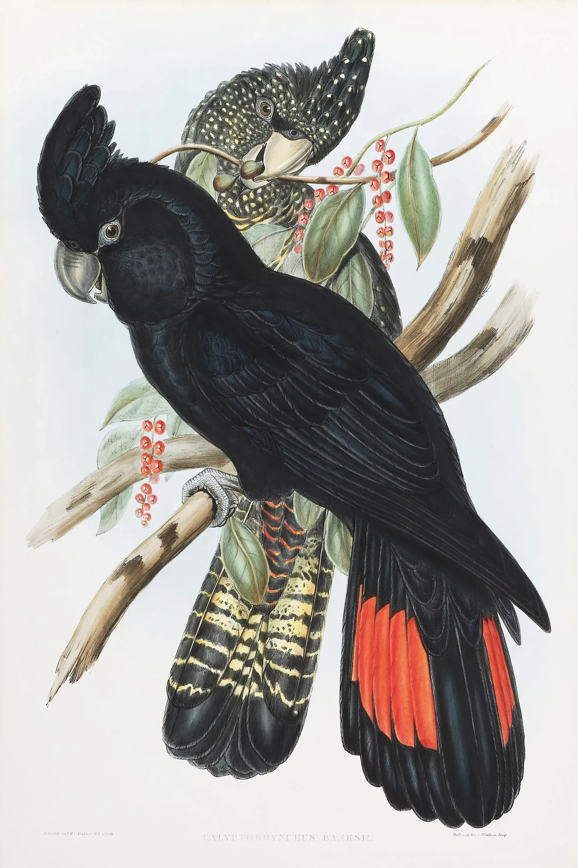
Calyptorhynchus Banksii
$23500
Magnificent and rare, c.19th original hand coloured lithograph of the Red-Tailed Black Cockatoo by John Gould from his epic series, The Birds of Australia and Adjacent Islands, published for the author, printed by Richard and John E. Taylor, London 1848.
View More
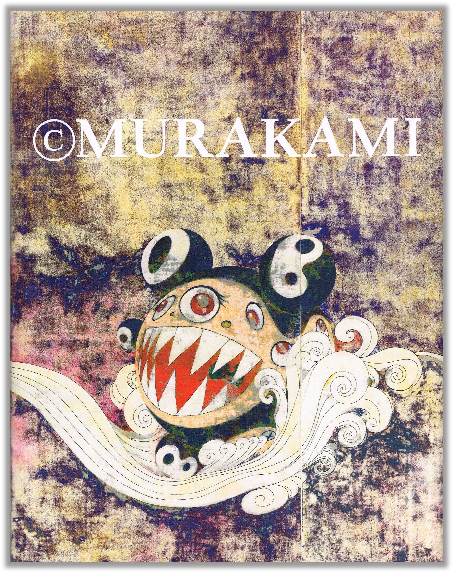
© MURAKAMI - Takashi Murakami
$150
This book was published on the occasion of © MURAKAMI, the first comprehensive survey of Takashi Murakami's work, at the Museum of Contemporary Art, Los Angeles between 2007-2008. With contributions from Dick Hebdige, Midori Matsui, Scott Rothkopf, Paul Schimmel, Jeremy Strick and Mika Yoshitake.
View More
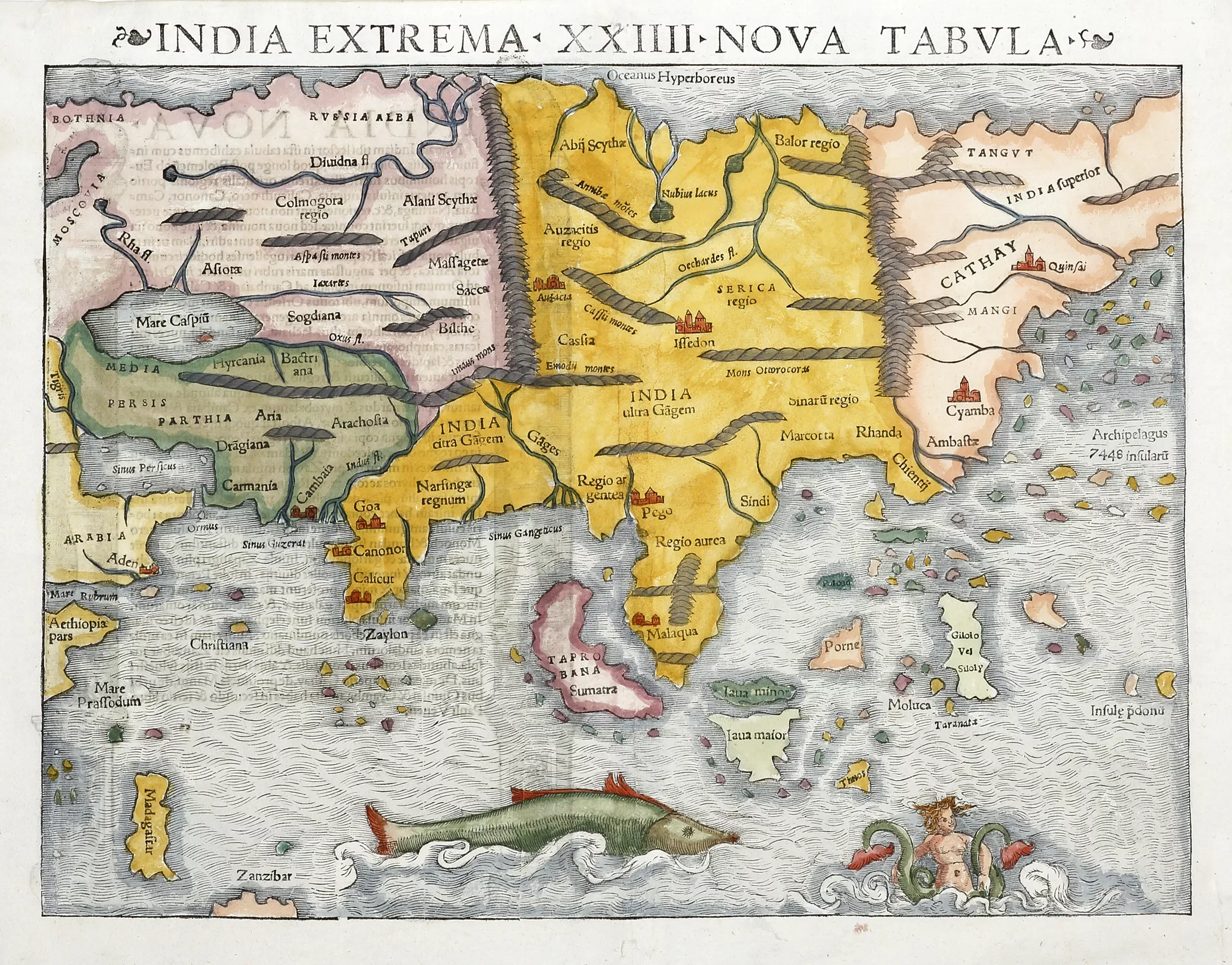
India Extrema XXIIII Nova Tabula
$2750
Important map of Asia published 1545 by Sebastian Munster. This woodcut map is one of the earliest published maps depicting the asian continent with information being derived from Portuguese sources.
View More
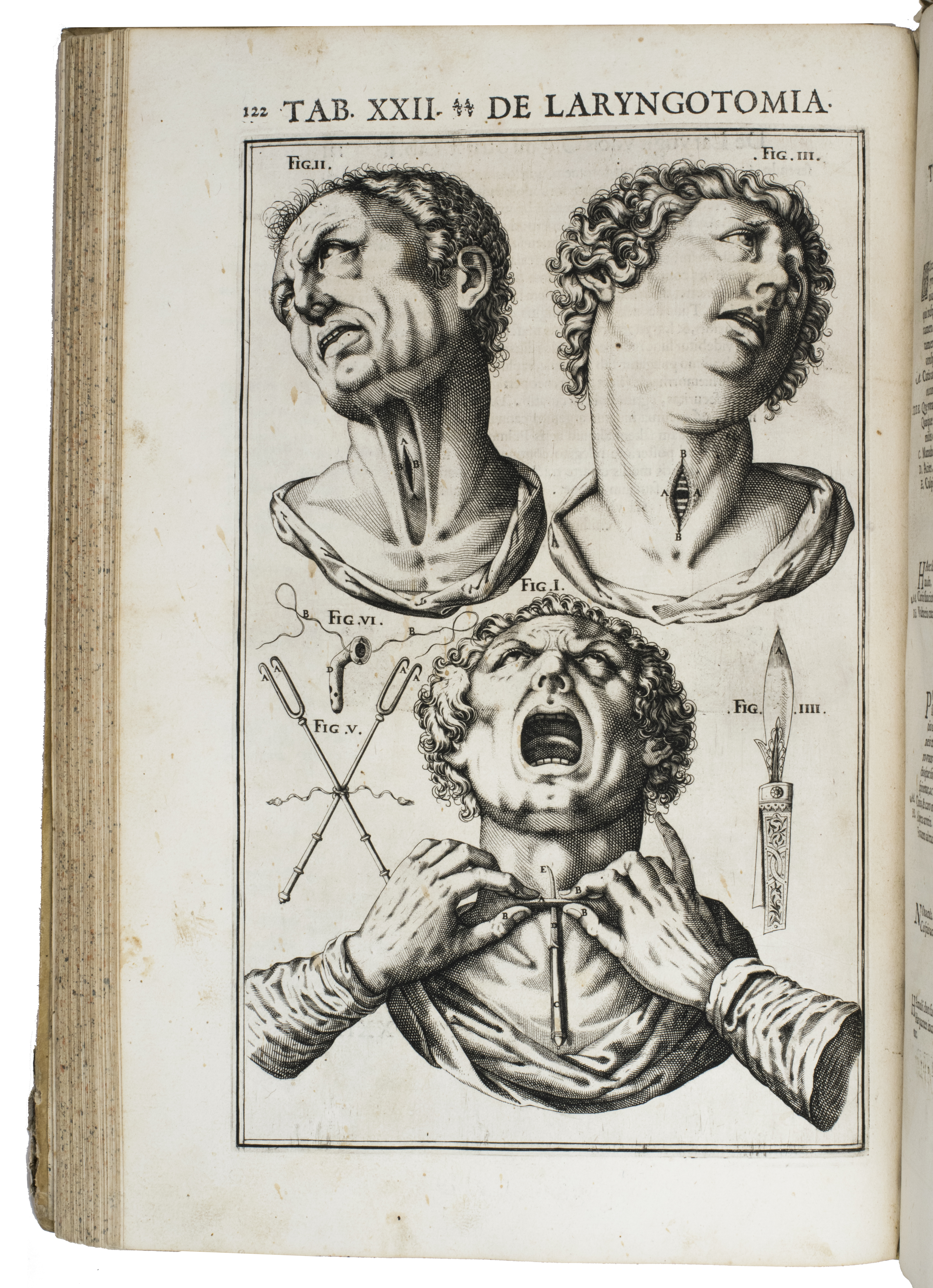
Beautifully illustrated first accurate monograph on the larynx, heavily influenced by Galen
$45000
CASSERIO, Giulio (Julius CASSERIUS). De vocis auditusq[ue] organis historia anatomica singulari fide methodo ac industria concinnata tractatibus duobus explicata ...
(Colophons: Ferrara, Victorius Baldinus, 1601 & "1600" [= 1601]). 2 parts in 1 volume. Royal folio (40.5 x 27.5 cm). With an engraved title page with the title in a large oval scrollwork cartouche surrounded by and incorporating dozens of skeletons and skulls of people and animals, 2 full-page engraved portraits (of the dedicatee Ranuccio I Farnese, Duke of Parma, and the author) and 34 full-page anatomical engravings.
View More
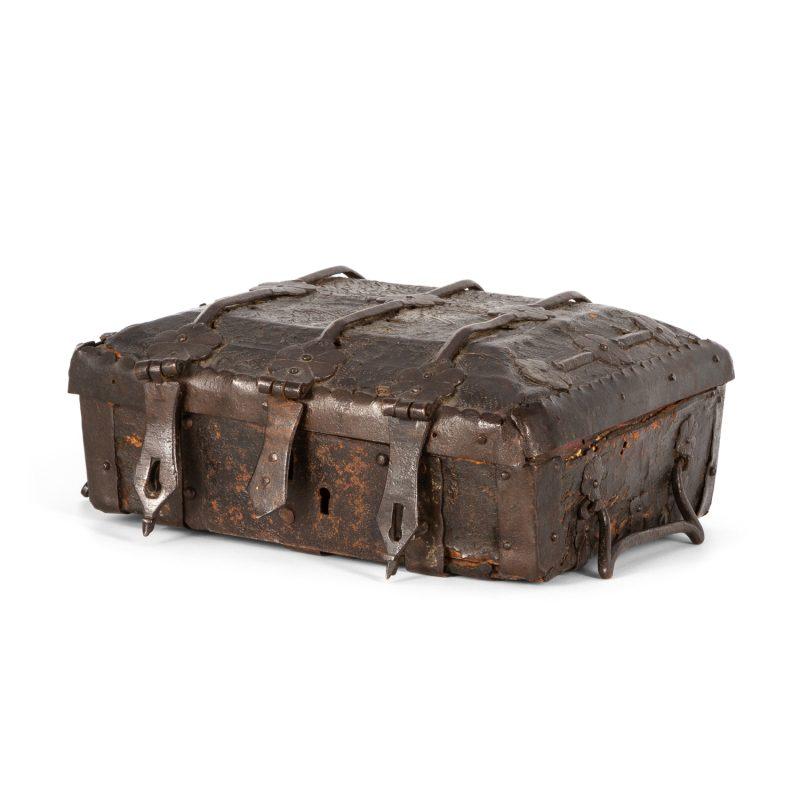
A rare fourteenth-century medieval casket for a Book of Hours
$40000
This is an excellent example of a distinct corpus of book boxes from Catalonia (northeastern Spain), usually associated with the later fourteenth century. Made of wood, the exterior has typical incised leather decoration in a whorl pattern. The rosette decorations on the wrought-iron reinforcements are found on virtually all the known extant examples. The tawed leather interior, with its gently curved angles and smooth surface, is indicative of the precious contents which the container was designed to protect.
View More
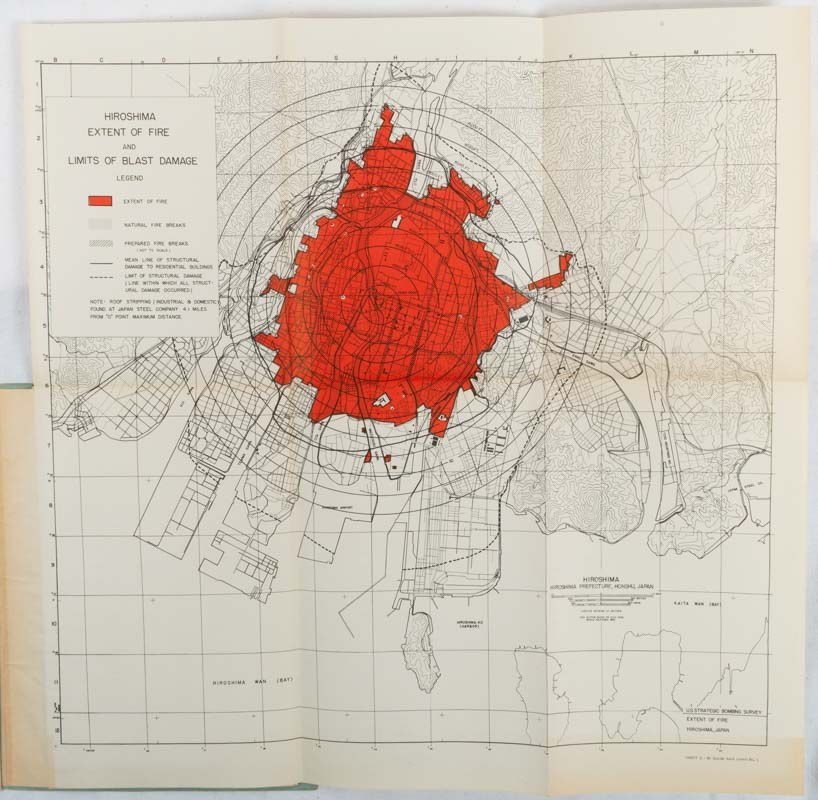
The Effects of Atomic Bombs on Hiroshima and Nagasaki.
$1250
A fascinating and illuminating survey of the damage wrought by the atomic bombings of Hiroshima and Nagasaki, compiled by American authorities following Japan's surrender. An almost serene level of cold detachment typifies the report's language, and despite being punctuated by examples of tragic and desperately human imagery and experiences, their accompanying captions and highly detailed retellings of events are mechanical to the point of being sublimely inhuman. A deeply valuable resource for students of atomic warfare and the post-atomic age.
View More
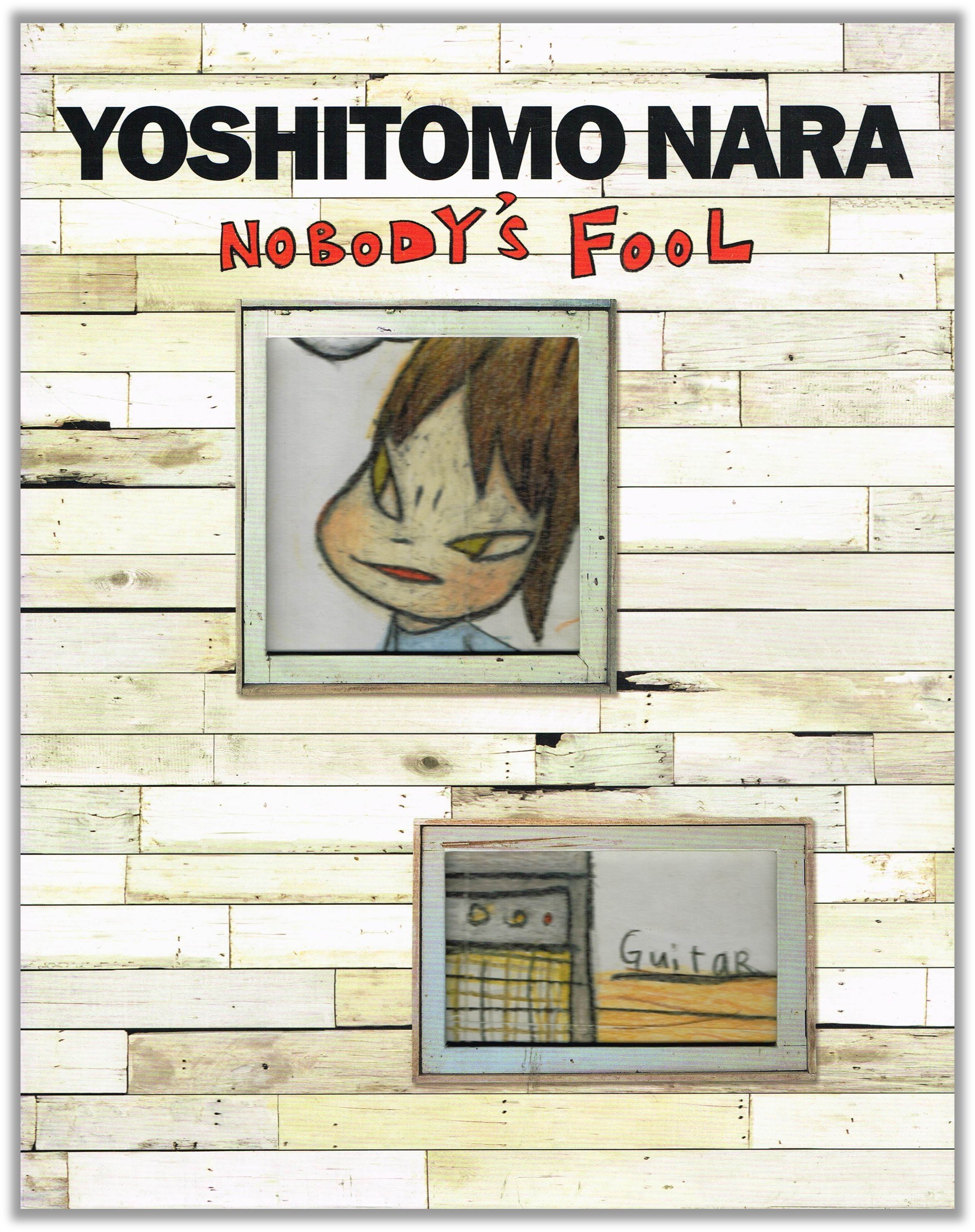
Nobody's Fool - Yoshitomo Nara
$250
Catalogue of the first major New York exhibition of Yoshitomo Nara (1959), and features more than one hundred works ranging from his early career in the 1980s to his most recent paintings, drawings, sculptures, ceramics, and large-scale installations.
View More
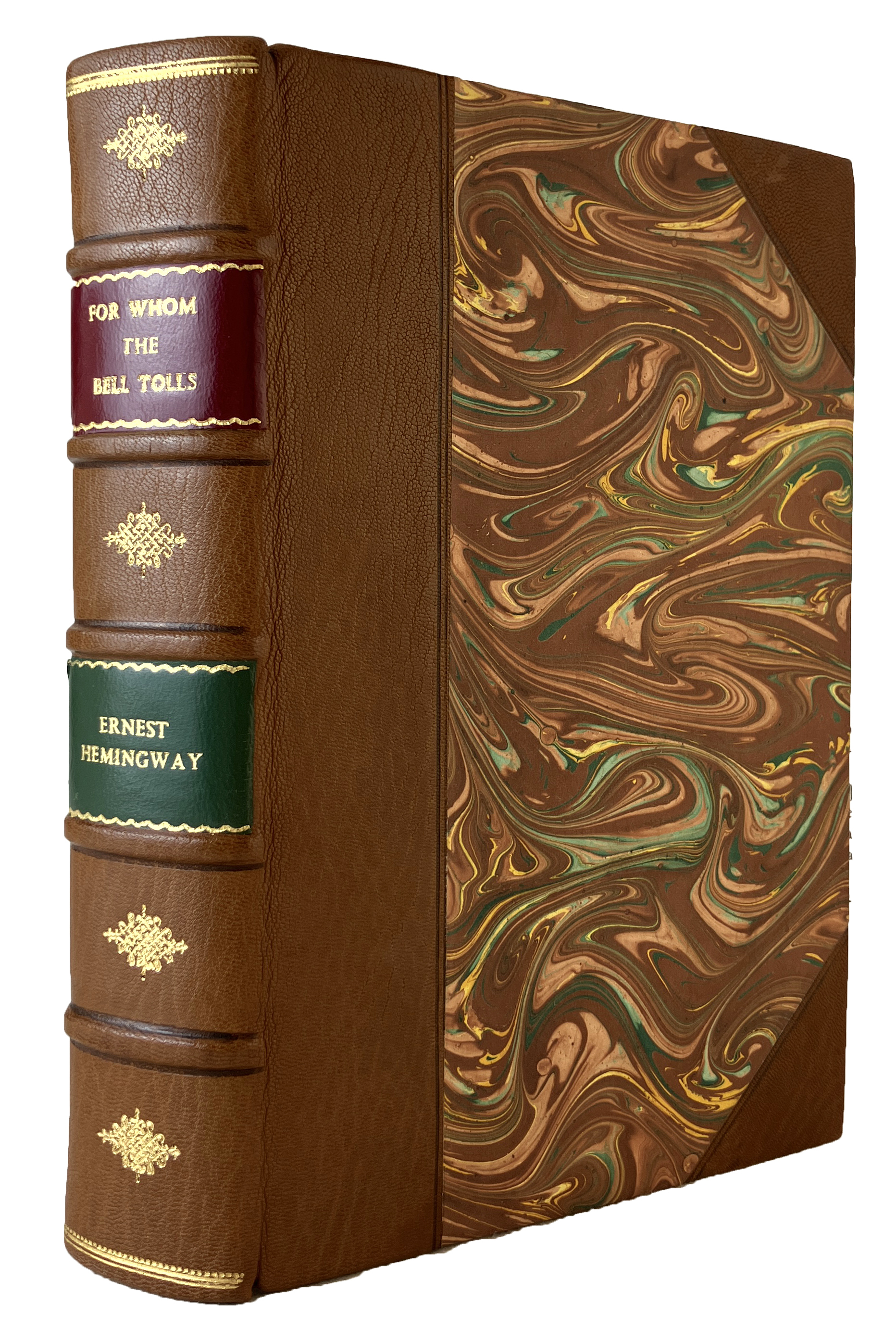
Hemingway, Ernest FOR WHOM THE BELL TOLLS.
$3000
Pp. [x]+472(last blank); post 8vo; rebound in half brown morocco, the spine lettered and decorated in gilt between raised bands, with contrasting red & green leather author and title labels, marbled papered boards; top edges brown; fore-edges of leaves faintly foxed; Charles Scribner's Sons, New York, 1940. First edition. Grissom A.17.1.a; Hanneman A18A. *Hemingway's most famous novel; the basis for a 1943 Paramount film starring Gary Cooper and Ingrid Bergman.
View More
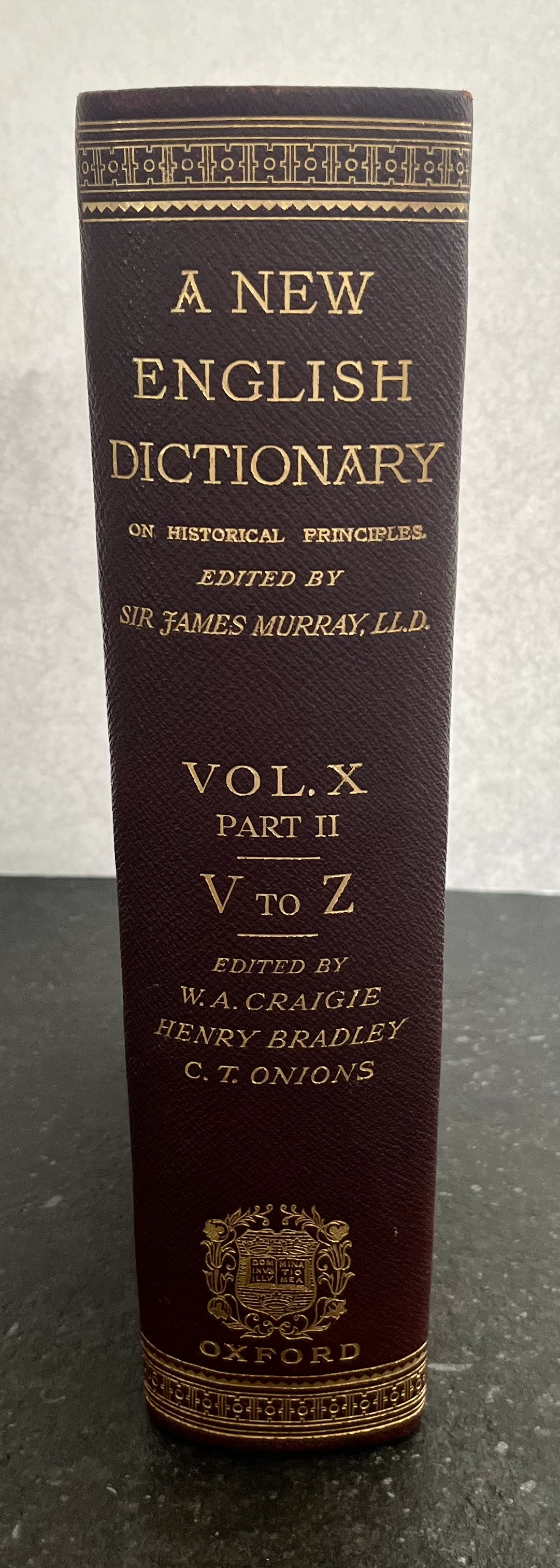
New English Dictionary - 20 Volumes
$9000
First Edition Set, A New English Dictionary on Historical Principles, 20 volumes. Founded mainly on the materials collected by the Philological Society. Edited by Sir James Murray, sometime president of the Philological Society, with the assistance of many scholars and men of science. Published Clarendon Press, Oxford, 1888 - 1928 (First Volume Published 1888 and last in 1928). A combination of burgundy and red leather hardbound covers. Gilt cornering and lining on covers, and gilt lettering on spine. Very Good - Excellent Condition.
View More
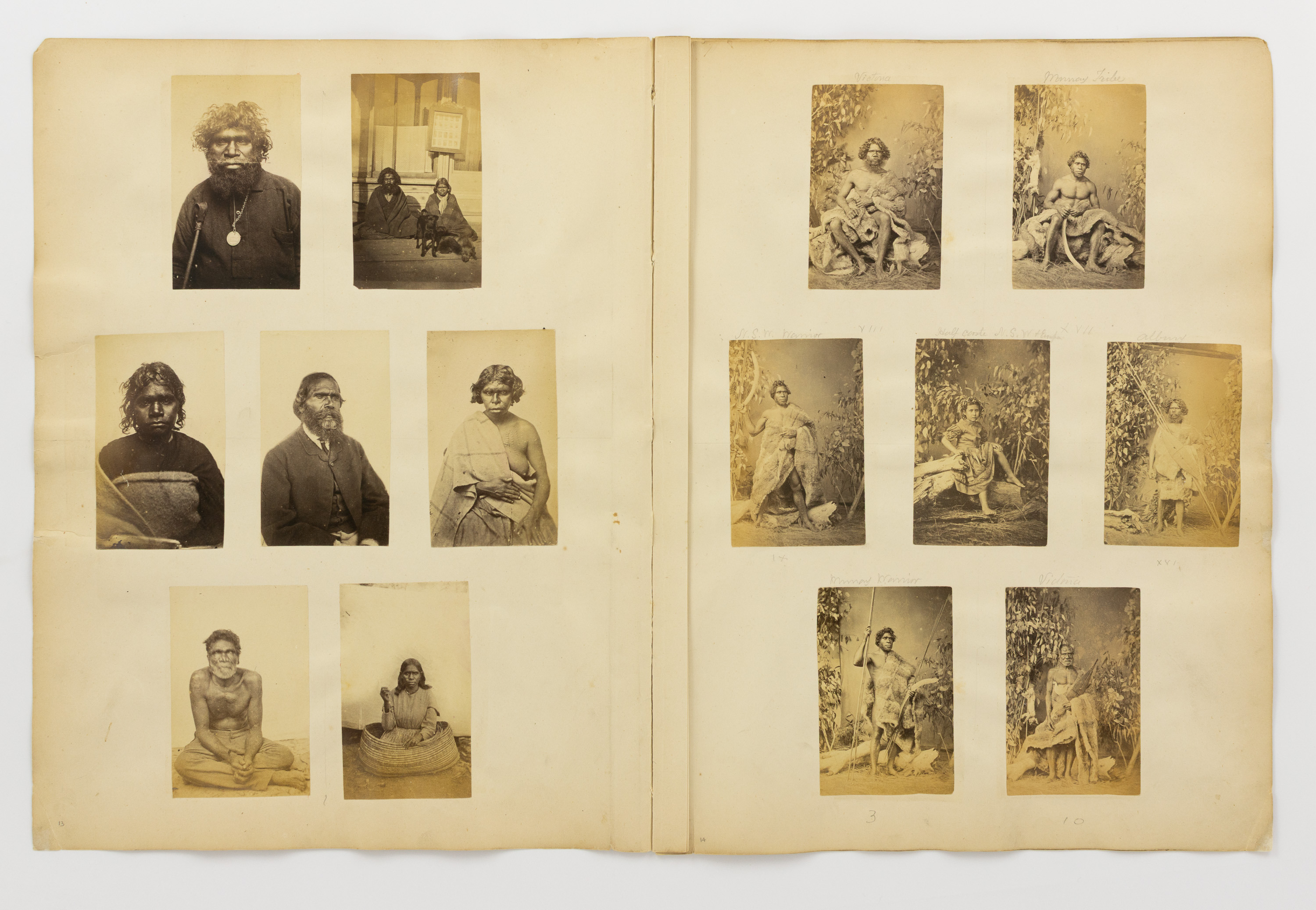
WASHBOURNE, Thomas: A collection of 24 carte-de-visite portrait photographs of Indigenous Australians, circa 1860s, most from the Yarra Valley and North-East Victoria
$45000
The Aboriginal portraits of Thomas Jeston Washbourne (1832-1905) are rare on the open market and in institutional holdings. The images comprise a series of ten tableaux taken in or near Wangaratta around 1866, and fourteen further portraits, most likely taken at Coranderrk Aboriginal Station (and almost certainly also by Washbourne)
View More
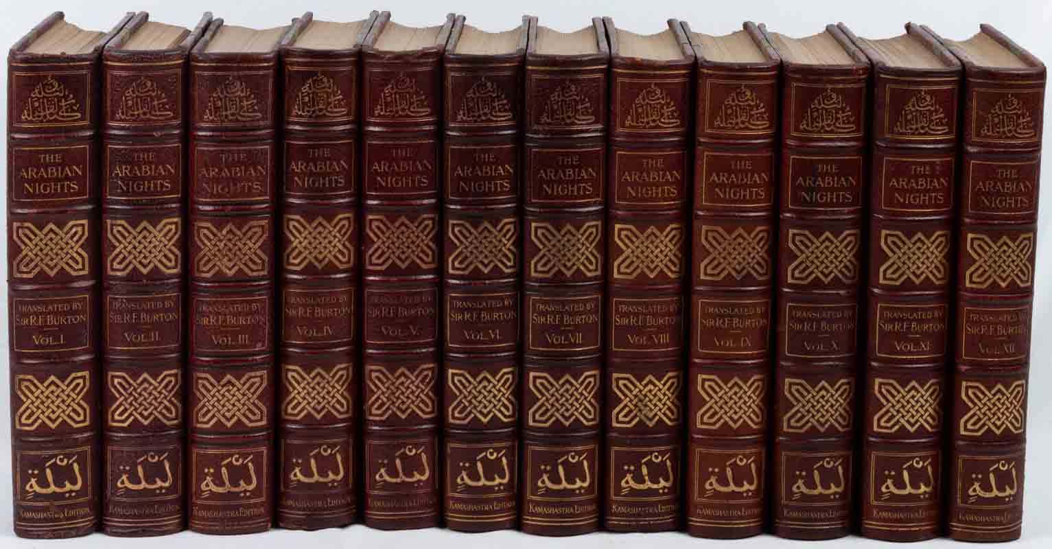
Richard F. Burton's Translation of the Arabian Nights.
$3500
The handsome H.S. Nichols' Library Edition of Burton's classic work with fine photogravure illustrations. Nichols included reproductions of the original "Kamashastra Society" title pages.
View More
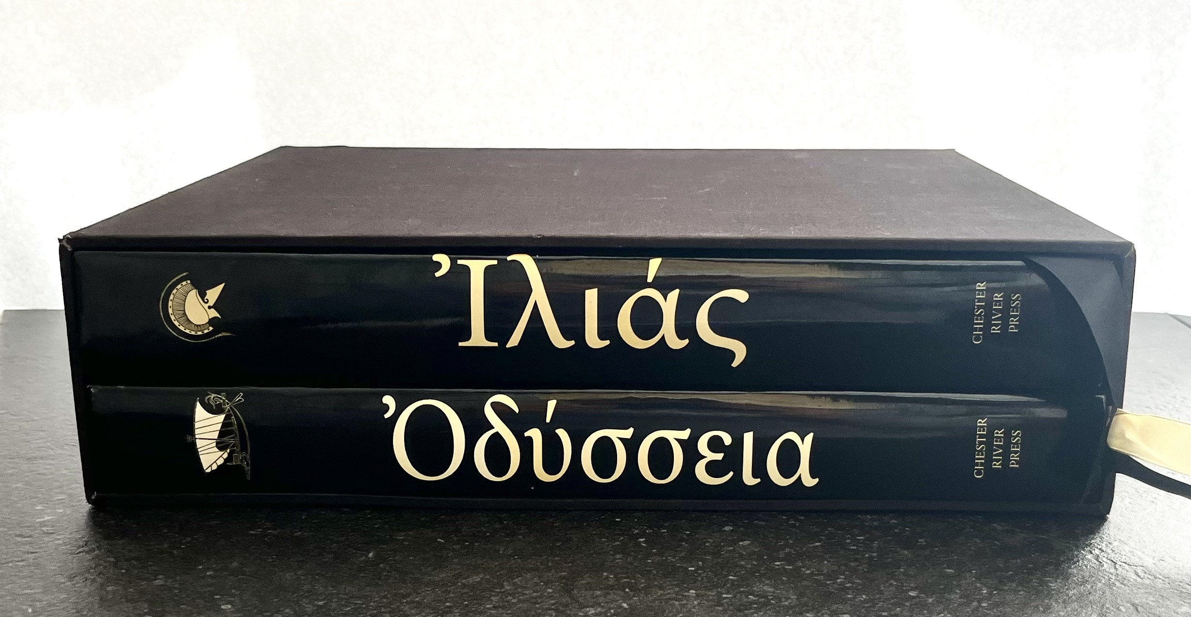
ILIAD + ODYSSEY
$600
Homer, ILIAD + ODYSSEY, Chester River Press.
2 Volumes in Slipcase.
Text in Greek and English, Translation by Alexander Pope.
Coloured Illustrations (full page) of Ancient Greek Artefacts.
Folio Set 2009.
Excellent Condition.
View More