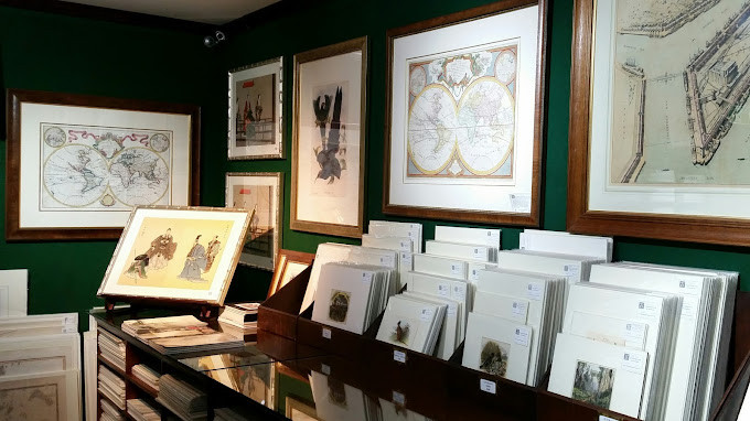
Antique Print Map Room
Member of ANZAAB - Australia
-
Colonial Paintings & Prints
Fine & Rare Books
Maps
Prints
Voyages & Exploration
Voyages to Australia
Specialist dealer of rare antique maps and prints. Our online store offers more than 15,000 genuine rare maps, antique prints, lithographs, engravings, books, ephemera and original artworks. Free shipping Australia wide.

Contact Information
Email: info@antiqueprintmaproom.com
Phone: +0431 698 717
Website: http://www.antiqueprintmaproom.com
Loading map...
392 Jones St Shop 189 Ultimo, 2007 Australia Get Directions
Store Hours
Hours Mon-Fri 11am-3pm (earlier or later by appointment) Closed Sat & Sun & public holidays
Highlights
Nova, et Integra Universi Orbis Descriptio.
$65000
Oronce Fine’s famous double cordiform map of the world is acknowledged as being one of the most striking and influential world maps published in the c.16th.
View More
Pennant’ Outlines of the Globe, vol. 4
$4850
The rare fourth volume of Pennant’s Outlines of the globe containing the large map of Australia, titled: Map For Mr. Pennants Outline of the Globe. Beautifully bound in striking contemporary hand painted tree calf
View More
Orbis Terrarum Nova et Accuratissima Tabula.
$11500
Second state of van Loon’s famous, rare double hemisphere map of the world first printed in Amsterdam 1666, issued with the additions of the dedication to Charles II and his coat-of-arms for Moses Pitt’s English Atlas.
View More
Universalis Orbis Descripti
$6250
Rare C.16th woodcut map of the world on an ovaloid projection set within an ornate framework and surrounded by sixteen wind heads by Joannes Myritius (1534-1587).
View More
Chart of the N. and W. Parts of Bass’s Straits
$6750
Rare and important, early c.19th hand coloured engraved chart by Lieutenant James Grant who was given command of the Lady Nelson with the instructions to sail her to Sydney and hand her over to Matthew Flinders.
View More
City of Brisbane, Queensland.
$4750
Very rare, large c.19th hand coloured panorama of Brisbane depicting the wharves at Petrie’s Bight, from a vantage point near All Hallows School, by Albert Henry Fullwood (1863-1930).
View More
The Resolution beating through the ice, with the Discovery in the most eminent danger
$3500
Important, early c.19th hand coloured aquatint by John Webber (1752-1793) artist on Cook’s third and final voyage depicting the Resolution and the Discovery surrounded by ice flows.
View More
Hobart Town
$2450
Rare c.19th detailed hand coloured engraved panorama of Hobart published in 1879. From the original edition of the Australasian Sketcher.
View More
La Nuova Olanda e la Nuova Guinea delineato sulle ultime osservazioni
$9250
Very rare and important c.18th map of Australia based on Cook’s first voyage observations and one of only a handful of maps to be solely devoted to the Australia continent.
View More